Belem Maps and Orientation
(Belem, Pará, Brazil)
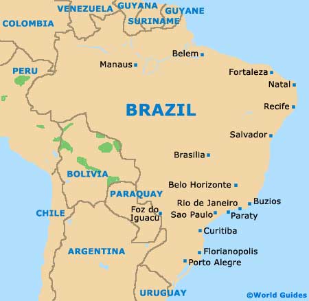
Capital of the Brazilian state of Pará, Belem is to be found close to the Amazon River's mouth, alongside the Bay of Guajará, the River Pará and the River Tocantins. Sited on the northerly side of
Brazil, Belem is known for its busy river port and was founded some 400 years ago.
Belem is located approximately 100 km / 62 miles from the coastline of the South Atlantic Ocean and is surrounded by a series of small bays and islets, the majority of which remain uninhabited. Close by, both the islands of Caratateua and Mosqueiro make for popular excursions, being home to some particularly appealing beaches.
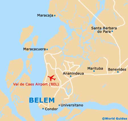
Maps and Orientation of the City
The city's central park is named the Praca da Republica and remains a relatively peaceful and serene spot, even though it is surrounded by busy roads, such as the Avenida Assis de Vasconelos and the Avenida Pres Vargas. Lying on the western side of the park is the Comercio (Commercial) district of Belem, which is near to the waterfront and best avoided at night.
Head southwards and you will soon encounter the Cidade Velha (Old City), where many characterful period buildings and leading museums are based. To the east of central Belem is the trendy neighbourhood of Nazaré, where a selection of eateries and hotels stand, together with the notable church - the Basilica Santuario de Nazaré.
If you are looking to purchase maps of Belem during your stay, then bookstores are located at the airport, in the Shopping Patio complex and at the Paratur tourist outlet on the Praca Waldemar Henrique.
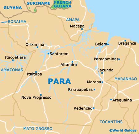
- Abaetetuba - south-west
- Acara - south-east
- Ananindeua - north-east
- Barcarena - south-west
- Benevides - north-east
- Capanema - east
- Castanhal - east
- Curuca - north-east
- Igarape Miri - south-west
- Marapanim - north-east
- Moju - south
- Santa Isabel do Para - east
- Sao Miguel do Guama - east
- Tome-Acu - south-east
- Vigia - north-east
Map of Brazil
Map of Para
Map of Belem