Brasilia Maps and Orientation
(Brasilia, Federal District, Brazil)
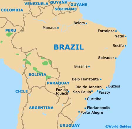
Brazil's proud national capital, the city of Brasilia is situated within the Central-West area of the country, on a plateau named the Planalto Central (Brazilian Highlands). Metropolitan Brasilia is home to an overall population just shy of four million people and contains almost 100 foreign embassies.
A relatively youthful city, Brasilia was founded, planned and developed in the mid-1950s and when viewed from high above, its ambitious layout resembles the shape of a plane. Many people now refer to Brasilia as simply the Capital Federal, with locals tending to be known as either 'Candangos' or 'Brasilienses'.
Maps and Orientation of the City
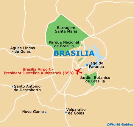
An integral part of the city's design is the curving Eixo Rodoviário (Highway Axis), which runs in a north to south-west direction and links prominent districts. Heading north-west to south-east is the equally important Eixo Monumental (Monumental Axis), with many of Brasilia's municipal buildings residing on the north-western side and legislative buildings on the south-eastern end, near to the Square of Three Powers and the shoreline of the man-made Lago do Paranoa (Lake Paranoa).
Forming the cockpit of the Brasilia airplane plan is the Plaza of Three Powers, which is made up of the Palacio do Congresso, the Palacio da Justica and the Palacio Planalto. The wings of the plane are known as 'asas' and where you will find a mixture of commercial blocks and endless apartment buildings.
Maps of the city are readily available at bookstores within the Shopping Brasilia and Conjunto Nacional malls, as well as at the airport's CAT tourist office and the CTR Turismo outlet in the Quadra 1 section of the Hotel Sector South area.
- Abadiania - 114 km / 71 miles (one hour and 45 minutes, south-west)
- Aguas Lindas de Goias - 37 km / 23 miles (45 minutes, west)
- Alto Paraiso de Goias - 220 km / 137 miles (three hours, north)
- Anapolis - 149 km / 93 miles ( two hours and ten minutes, south-west)
- Aparecida de Goiania - 214 km / 133 miles (three hours, south-west)
- Arinos - 231 km / 144 miles (three hours and 15 minutes, east)
- Cidade Ocidental - 46 km / 29 miles (55 minutes, south)
- Cristalina - 131 km / 81 miles (two hours, south)
- Formosa - 81 km / 50 miles (one hour and 35 minutes, east)
- Goiania - 205 km / 127 miles (three hours, south-west)
- Luziania - 56 km / 35 miles (one hour and ten minutes, south)
- Novo Gama - 38 km / 24 miles (45 minutes, south)
- Orizona - 198 km / 123 miles ( two hours and 45 minutes, south)
- Pires do Rio - 249 km / 155 miles (three hours and 25 minutes, south)
- Planaltina - 51 km / 32 miles (one hour, north-east)
- Santo Antonio do Descoberto - 47 km / 29 miles (55 minutes, south-west)
- Valparaiso de Goias - 36 km / 22 miles (40 minutes, south)
Map of Brazil
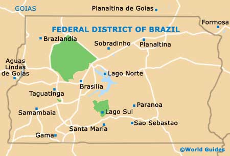
Map of Federal District of Brazil
Map of Brasilia