Hamilton Maps and Orientation
(Hamilton, Pembroke, Bermuda)
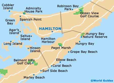
Hamilton city is located right at the centre of
Bermuda, within easy reach of just about any attraction on the island. Visitors are advised to invest in the maps provided by hotels or any number of shops on Front Street, as they greatly simplify navigating the sounds and odd-angled waterways that cut into Bermuda.
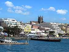
The main thoroughfare in Hamilton is Front Street, which follows the harbour and plays host to the city's most important commercial strip. Cruise ships dock here, tourists stroll along the waterfront and locals come out to celebrate festivals, attend church services or to simply enjoy the scene with friends and family.
Maps and Orientation of the City
North of Hamilton is North Shore Road, another important avenue that brings together the island's eastern and western extremities. This is technically out of Hamilton city limits, but is only a few minutes away by bus or scooter, and has several important attractions that tourists will want to see.
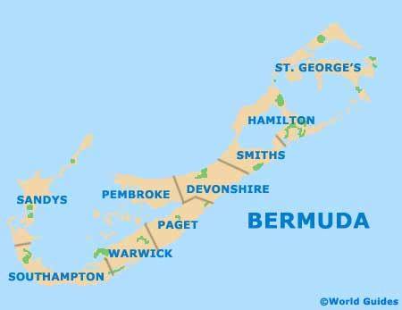
One important thing to note on a map of Bermuda is the fact that Hamilton is both the name of a city and the name of a parish. The parish predates the city, but does not actually contain it. All the same, this is a small island, and most attractions in Hamilton parish are only a few miles away from the city.
- Bailey's Bay - 11 km / 7 miles (15 minutes, north-east)
- Crystal Cave - 12 km / 8 miles (15 minutes, north-east)
- Elbow Beach - 5 km / 3 miles (ten minutes, south)
- Flatts Village - 6 km / 4 miles (eight minutes, north-east)
- Harrington Sound - 11 km / 7 miles (15 minutes, north-east)
- Paget Marsh - 4 km / 2.5 miles (eight minutes, south)
- Somerset Village - 19 km / 11 miles (25 minutes, west)
- St. George's - 19 km / 12 miles (25 minutes, north-east)
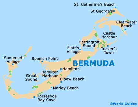
Map of Bermuda
Map of Parishes
Map of Hamilton
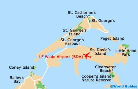
Bermuda International (L F Wade) Airport Map