Malaga Maps and Orientation
(Malaga, Costa del Sol, Spain)
Located on the southern coastline of Spain, the popular city resort of Malaga resides within the Autonomous Community of Andalucia, where it is the second-most densely populated city. Malaga is actually the most southerly of all Europe's cities and is found on the famous Costa del Sol, fronting the Mediterranean Sea.
Home to a population of just over 550,000 people, this is a sizable city, with the easiest way to navigate Malaga being to pinpoint the principal streets. Particularly prominent is the Paseo del Parque, which is lined with tropical palm trees, while the Alameda Principal is another major thoroughfare and edges the Old Town's boundary.
Maps and Orientation of the City
Other notable streets include the Calle Molina Lario and the Calle Marques de Larios, which connect the Old Town from its southern side. To the east, the Gibralfaro Hill presides over the Paseo del Parque.
An easy way to reach the bus and railway stations is simply to find the Avenida de Andalucia, and then walk in a southerly direction for a few minutes, following the signs. Bringing maps will certainly help you find your way around Malaga, with local maps being available at most good hotels and at the tourist office on the Avenida de Cervantes.
- Alhaurin el Grande - 38 km / 24 miles (55 minutes, west)
- Almunecar - 75 km / 47 miles (one hour and 30 minutes, east)
- Antequera - 63 km / 39 miles (one hour and 25 minutes, north)
- Benalmadena - 28 km / 17 miles (40 minutes, south-west)
- Cartama - 20 km / 12 miles (30 minutes, west)
- Casabermeja - 25 km / 16 miles (35 minutes, north)
- Casarabonela - 44 km / 27 miles (one hour, west)
- Estepona - 89 km / 55 miles (one hour and 40 minutes, south-west)
- Fuengirola - 33 km / 21 miles (45 minutes, south-west)
- Granada - 135 km / 84 miles (two hours, north-east)
- Loja - 83 km / 52 miles (one hour and 35 minutes, north-east)
- Marbella - 59 km / 37 miles (one hour and 15 minutes, south-west)
- Nerja - 55 km / 34 miles (one hour and ten minutes, east)
- Torremolinos - 17 km / 11 miles (25 minutes, south-west)
- Velez-Malaga - 35 km / 22 miles (50 minutes, east)
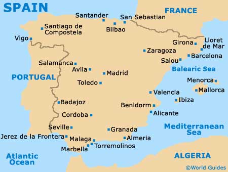
Map of Spain

Map of Malaga


