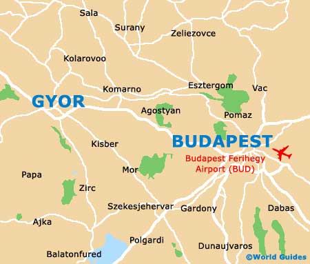
Gyor Maps and Orientation
(Gyor, Gyor-Moson-Sopron, Hungary)
A prominent city on the north-western side of
Hungary, Gyor is located within the county of Gyor-Moson-Sopron and the region of Western Transdanubia. Gyor is situated between the cities of the Hungarian capital of
Budapest, and also the capital of Austria, Vienna, both of which are just over 120 km / 75 miles away.
Currently Hungary's sixth-biggest city and the home of some 130,000 residents, Gyor has an ancient heritage and is known for its historic Roman settlements, that were based here, in the centre of the Little Plain (Kisalföld), about 200 years ago.
Maps and Orientation of the City
Today, Gyor embraces its past and boasts a strong medieval character around much of the city, with attractive terracotta-roofed buildings and public squares, such as Széchenyi Square. The railway station lies along the Révai Miklós Utca, on the southern side of Soldier Park (Honvéd Liget). The Gyor bus station is close by, on the Hunyadi Utca, being reached by the convenient underpass.
The historic Inner Town area of Gyor is known as the Belváros and is situated off the Baross Gábor Utca. To navigate your way around this part of Gyor and the rest of the city, maps are available at the Tourinform office on the Arpad Utca, close to the county hall.
- Bábolna - 40 km / 25 miles (35 minutes, east)
- Bratislava (Slovakia) - 78 km / 48 miles (one hour, north-west)
- Budapest - 128 km / 80 miles (one hour and 40 minutes, south-east)
- Csorna - 33 km / 21 miles (30 minutes, west)
- Györujbarát - 12 km / 7 miles (20 minutes, south)
- Komárno - 54 km / 34 miles (40 minutes, east)
- Mosonmagyaróvár - 41 km / 25 miles (35 minutes, north-west)
- Nové Zámky - 83 km / 52 miles (one hour and five minutes, north-east)
- Pannonhalma - 20 km / 12 miles (25 minutes, south)
- Pápa - 45 km / 28 miles (40 minutes, south)
- Sopron - 87 km / 54 miles (one hour and ten minutes, west)
- Szombathely - 106 km / 66 miles (one hour and 30 minutes, south-west)
- Tatabánya - 70 km / 43 miles (one hour and five minutes, south-east)
- Vienna (Austria) - 122 km / 76 miles (one hour and 40 minutes, north-west)
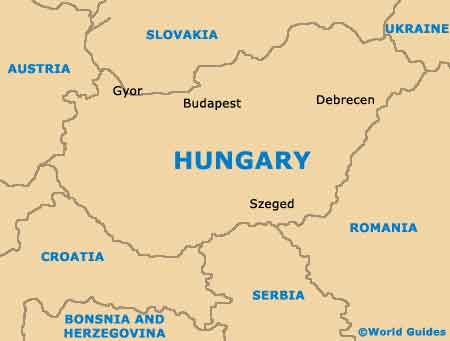
Map of Hungary
Map of Gyor