Dusseldorf Maps and Orientation
(Dusseldorf, North Rhine-Westphalia, Germany)
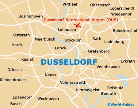
Sited within western Germany's state of North Rhine-Westphalia, Dusseldorf is the region's capital city and one of the premier economic centres in this part of the country. A modern city with good connections to the rest of Germany, Dusseldorf International Airport is just minutes away and can be found on the northern outskirts of Dusseldorf historic old quarter of Altstadt.
The majority of Dusseldorf lies on the eastern side of the Rhine River and in recent years, has become a major centre for many German telecommunications companies, banks and the stock market. As a result, many parts of Dusseldorf are a true mixture between old and new, with the Rheinturm telecommunications tower being the city's highest structure by far and dominating much of the area around the Stromstrasse.
Maps and Orientation of the City
The Altstadt district of Dusseldorf is particularly notable and consists of many pedestrianised lanes, which run alongside the Rhine River. The Marktplatz is the true heart of this colourful and inviting neighbourhood.
On the south-eastern side of Dusseldorf city centre you will find the main railway station, otherwise known as the Hauptbahnhof. Nearby, the Bismarckstrasse is a major thoroughfare and leads to much of the action. Outside of the city, a true assortment of cities and tourist destinations await, with the following being especially close.
- Cologne - 37 km / 23 miles (30 minutes, south)
- Dormagen - 19 km / 12 miles (18 minutes, south)
- Duisburg - 37 km / 23 miles (30 minutes, north)
- Erkrath - 16 km / 10 miles (20 minutes, east)
- Essen - 38 km / 24 miles (30 minutes, north-east)
- Heiligenhaus - 34 km / 21 miles (30 minutes, north-east)
- Kaarst - 13 km / 8 miles (12 minutes, west)
- Krefeld - 27 km / 17 miles (25 minutes, north-west)
- Meerbusch - 8 km / 5 miles (12 minutes, north-west)
- Neuss - 8 km / 5 miles (12 minutes, west)
- Ratingen - 13 km / 8 miles (20 minutes, north-east)
- Remscheid - 42 km / 26 miles (40 minutes, east)
- Solingen - 27 km / 17 miles (25 minutes, east)
- Willich - 22 km / 14 miles (20 minutes, west)
- Wuppertal - 35 km / 22 miles (30 minutes, north-east)
Map of Germany

Map of Dusseldorf