Hanover Maps and Orientation
(Hanover, Lower Saxony, Germany)
A prominent city in northern Germany, Hanover lies within the Lower Saxony state and directly south of
Hamburg. Founded at the beginning of the 12th century, the city of Hanover has grown dramatically in both size and shape, from a small, humble fishing village to become the state capital, with a population today of well over half a million people.
Hanover has earned itself a strong reputation for hosting enormous commercial expositions and trade fairs, many of which take place at the vast Hanover Fairground, which is amongst the biggest of its kind in the whole world. The city has been built up around the River Leine and has also become known for being home to a major airport, university and important local medical school.
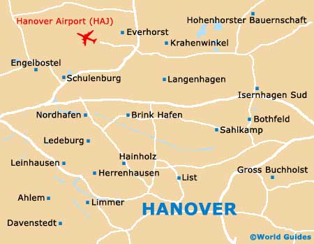
Maps and Orientation of the City
Hanover's central train station, referred to locally as the Hauptbahnhof, can be found to the north-east of the city centre and is easy to find. Within central Hanover itself, you will find that much of this district has been extensively pedestrianised and is easy to walk around, with notable thoroughfares including both Bahnhofstrasse and Georgstrasse.
Outside of the city it soon becomes clear that Hanover is a major transport hub in this part of Germany, with excellent connections to the country's extensive Autobahn network. This allows visitors to travel around the area with ease and investigate many of the surrounding cities and towns, such as those listed below.
- Bult - 3 km / 2 miles (5 minutes, east)
- Burgdorf - 22 km / 14 miles (22 minutes, north-east)
- Burgwedel - 22 km / 14 miles (22 minutes, north-east)
- Garbsen - 13 km / 8 miles (15 minutes, north-west)
- Gehrden - 14 km / 9 miles (18 minutes, south-west)
- Gottingen - 120 km / 75 miles (one hour and 30 minutes, south)
- Hamburg - 157 km / 98 miles (two hours, north)
- Hemmingen - 6 km / 4 miles (8 minutes, south)
- Isernhagen - 13 km / 8 miles (15 minutes, north-east)
- Laatzen - 13 km / 8 miles (15 minutes, south)
- Langenhagen - 10 km / 6 miles (14 minutes, north)
- Lehrte - 21 km / 13 miles (20 minutes, east)
- Maspe - 19 km / 12 miles (20 minutes, north)
- Pattensen - 14 km / 9 miles (18 minutes, south)
- Seelze - 13 km / 8 miles (15 minutes, west)
- Sehnde - 19 km / 12 miles (20 minutes, south-east)
Map of Germany

Map of Hanover