Le Mans Maps and Orientation
(Le Mans, Pays de la Loire, France)
A famous French city located within the Pays de la Loire region and the Maine province, Le Mans is a fairly historic city. The old quarter is a particularly important part of Le Mans and known locally as either 'Vieux Mans' or the 'Cité Plantagenêt', being dominated by the stunning cathedral, which towers high over many of the surrounding buildings. Much of daily life in Le Mans revolves around the Place de la République and its large selection of underground shopping.
Further afield, many prominent cities and towns are within reach of Le Mans, either by car, bus or train. Many people visiting Le Mans choose to stay here for just a few days, often timing their trip with the legendary Le Mans car race, before moving on to neighbouring tourist locations. Others prefer to use the city as a good base for day trips. Excursions are a good way to familiarize yourself with the Le Mans area.
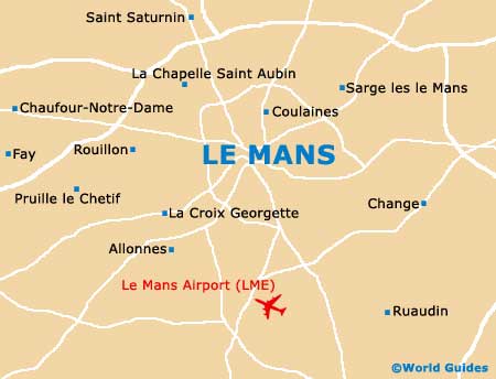
Maps and Orientation of the City
Even
Paris is less than three hours away from Le Mans and often combined in a French vacation. Further north, the coastline around Caen and Le Havre is especially attractive, while to the north-east, La Madeleine and its famous Utah Beach are well worth the journey, being close to the Cotentin Peninsula in the Normandy region. When journeying to this area from Le Mans, if possible, drive through the town of the Manche Département, where the Sainte Mère Église church is particularly famous, and features a dummy paratrouper and parachute hanging from the church spire.
- Alencon - 53 km / 33 miles (45 minutes - north)
- Angers - 96 km / 60 miles (one hour and 10 minutes - south-west)
- Blois - 144 km / 90 miles (one hour and 45 minutes - east)
- Chartres - 120 km / 75 miles (one hour and 30 minutes - north-east)
- Laval - 85 km / 53 miles (one hour and 5 minutes - west)
- Nantes - 184 km / 115 miles (two hours and 10 minutes - south-west)
- Orléans - 196 km / 122 miles (two hours and 40 minutes - east)
- Paris - 209 km / 130 miles (two hours and 45 minutes - north-east)
- Rennes - 152 km / 95 miles (one hour and 55 minutes - west)
- Saumur - 120 km / 75 miles (one hour and 30 minutes - south)
- Tours - 99 km / 62 miles (one hour and 10 minutes - south-east)
Map of France

Map of Le Mans