Winchester Maps and Orientation
(Winchester, Hampshire, England, UK)
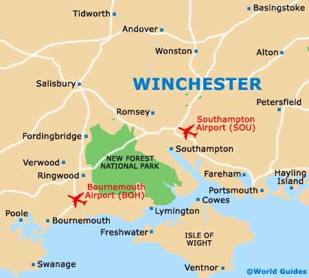
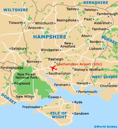
Located in the county of Hampshire and close to the southerly coastline of
England, the city of Winchester is quite compact and generally easy to find your way around on foot.
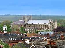
Winchester Cathedral is always a useful point of reference should you get lost or need to met up with friends.
The Buttercross and High Street areas are always busy and head west to east, through the centre of Winchester, being partially pedestrianised to cope with the high throughput of shoppers and seasonal sightseers. Most attractions either line this stretch or are just a short walk away.
Maps and Orientation of the City
The bus station is conveniently located in the very city centre and stands directly across from the Guildhall, where the Tourist Information Centre is located. Tourists should come here to pick up their free copy of the 'Winchester Visitor Guide', 'Pocket Guide' and 'Visitor Maps', which feature detailed maps of the city and surrounding region. There is also a handy 'access and parking map', suiting those driving by car or planning to make full use of the available public transport.
- Aldershot - 53 km / 33 miles (50 minutes, north-east)
- Andover - 29 km / 18 miles (30 minutes, north-west)
- Basingstoke - 34 km / 21 miles (35 minutes, north-east)
- Beaulieu - 37 km / 23 miles (35 minutes, north-east)
- Bournemouth - 64 km / 40 miles (one hour, south-west)
- Brighton - 117 km / 73 miles (one hour and 45 minutes, south-east)
- Chichester - 69 km / 43 miles (one hour and five minutes, south-east)
- Eastleigh - 13 km / 8 miles (15 minutes, south)
- Fareham - 40 km / 25 miles (40 minutes, south-east)
- Farnham - 43 km / 27 miles (45 minutes, north-east)
- Havant - 53 km / 33 miles (50 minutes, south-east)
- Isle of Wight (by ferry) - 66 km / 41 miles (two hours, south)
- Lymington - 48 km / 30 miles (45 minutes, south-west)
- Lyndhurst (New Forest) - 35 km / 22 miles (35 minutes, south-west)
- New Alresford - 13 km / 8 miles (15 minutes, east)
- Newbury - 43 km / 27 miles (40 minutes, north)
- Petersfield - 32 km / 20 miles (35 minutes, east)
- Poole - 70 km / 44 miles (one hour and five minutes, south-west)
- Portsmouth - 48 km / 30 miles (45 minutes, south-east)
- Ringwood - 46 km / 29 miles (45 minutes, south-west)
- Romsey - 19 km / 12 miles (20 minutes, south-west)
- Salisbury - 50 km / 31 miles (45 minutes, west)
- Southampton - 22 km / 14 miles (25 minutes, south)
- Waterlooville - 34 km / 21 miles (35 minutes, south-east)
- Whitchurch - 22 km / 14 miles (25 minutes, north)
Map of the United Kingdom

Map of Hampshire
Map of Winchester