Southampton Maps and Orientation
(Southampton, Hampshire, England, UK)
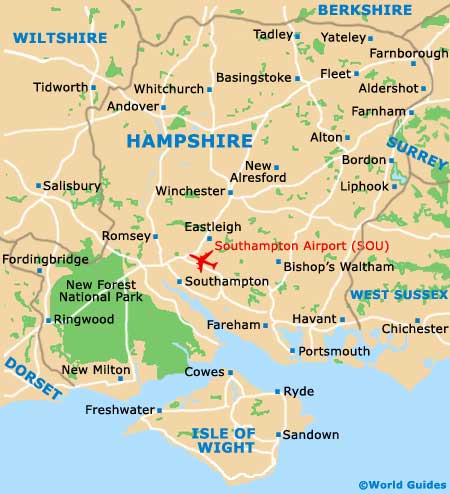
Southampton is located on the southern shoreline of England, between Portsmouth (to the east) and the New Forest National Park (to the west). The city of Southampton is close to many main roads, which link it to more northerly cities, with the M3 being especially prominent and heading to nearby London, passing Eastleigh,
Winchester, Basingstoke and Farnborough along the way.
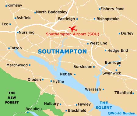
A surprisingly green city with many parks and public spaces, the city is centered around the Southampton Common, which is close to the University of Southampton, Winchester Road and The Avenue. Located in the county of Hampshire, Southampton sits alongside the River Test and the Southampton Water. The Isle of Wight is sited directly south and linked by many regularly ferries departing from the busy port.
Maps and Orientation of the City
Areas of interest close to Southampton include Totton, Netley Marsh and Cadbam to the west, Nursling, Chilworth, Romsey and North Baddesley to the north, and Hedge End, Botley and Wickham to the east. On the southern side of the city and across the water, the village of Hythe is a charming place to visit and features an excellent shopping area, based around its busy High Street.
Map of the United Kingdom

Map of Hampshire
Map of Southampton