Bournemouth Maps and Orientation
(Bournemouth, Dorset, England, UK)
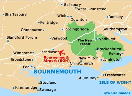
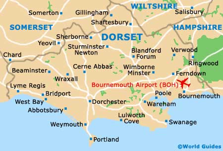
The popular seaside resort of Bournemouth is located within the county of Dorset and on the south coast of
England, within the Borough of Bournemouth. Close to
Boscombe (east), Christchurch (east) and
Poole (west), Bournemouth is the biggest town between
Plymouth and
Southampton, and is home to some 165,000 residents.
Bournemouth was founded around 200 years ago and its beautiful beachfront is centred around the town's traditional pier. The nearby Boscombe Pier is just a relatively short walk away and is also connected by a tourist land train, which runs along the scenic Undercliff Drive. Many visitors choose to park on the Undercliff Drive or along the cliff-top East Overcliff Drive, where the seafront views are nothing short of breathtaking.
Maps and Orientation of the City
The Lowers Gardens are a major feature of central Bournemouth and lead towards the pier, being bounded by Bourne Avenue, Exeter Crescent and Westover Road. Maps of the town and surrounding Dorset attractions are available from the tourist outlet on Westover Road, close to the Dingles department store and the Arcade.
Map of the United Kingdom

Map of Dorset
Map of Bournemouth