Truro Neighbourhoods, Locations and Districts
(Truro, Cornwall, England, UK)
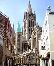
The city's skyline is dominated by the magnificent Truro Cathedral and its stunning Gothic spires. An important administrative centre in Cornwall and full of commerce, Truro boasts one of the largest and most extensive shopping districts in the whole of the county.
Truro is a relatively small city and features a number of stunning 18th-century town houses with traditional Bath-stone facades. Here is some information about Truro's layout, main districts, neighbourhoods and locations.
Orientation
On its southern side, the city is edged by Treyew Road, Green Lane, Morlaix Avenue and Tregolis Road, which together make up the A390. Prominent roads around the centre of Truro include Kenwyn Road, Carew Road and St. George Road, which stretches along the western side of the stunning Victoria Gardens.
Central Truro is full of shops, both large and small, and plenty of charming pubs to go around. Serving a range of local ales and fine country fare, pubs are scattered all over Truro and are never difficult to find, standing alongside many of the main roads, including the A390, the A39 and the A3076.
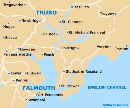
Whilst Truro may not be a coastal city, it is actually connected to the nearby sea, with the Truro River linking the scenic harbour with Falmouth and St. Mawes. Many ferries sail along this route and head southwards, joining the Tresillian River, the River Fal and the tidal waters of Falmouth's Estuary.
Truro stands within Cornwall's Carrick district, which is a prominent local area of government. This part of the county is a relatively new region, created in the early 1970s by merging a number of nearby boroughs together, including Penryn and Falmouth. Within Truro itself, the main districts, neighbourhoods and suburban areas include Kenwyn and Lower Comprigney on the north-western side, Moresk on the northern outskirts, Trelander to the east, and Redannick close to the very centre of Truro.