Brussels Maps and Orientation
(Brussels, Brussels-Capital Region, Belgium)
The Belgian city of Brussels has long been a prominent crossroads within Western Europe and within the region known as the Brussles-Capital, where it is the biggest and most significant municipality. This vibrant city is Belgium's capital and today boasts a population exceeding one million inhabitants.
Much of Brussels is bordered by a busy motorway ring road, which allows the city centre to be easily reached. Central Brussels is known for being split into two distinct regions, the Upper Town and also the Lower Town areas.
Maps and Orientation of the City
The Lower Town area is a great place to walk around and is very much centred around the Grand Place, which was once a bustling market square. Many cobblestone streets and charming quarters lie here, such as the Marolles and Saint Catherine. The Upper Town area of Brussels is located to the east of the Grand Place and is home to many long boulevards and imposing structures, such as the Palais Royal.
Various fold-up maps of Brussels are available and those with a street index tend to be the most useful for those planning to explore the city. The best maps are produced by De Rouck, Geocart and Michelin.
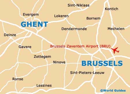
- Dendermonde - 43 km / 27 miles (45 minutes, north-west)
- Elsene - 5 km / 3 miles (5 minutes, south)
- Grimbergen - 16 km / 10 miles (22 minutes, north)
- Jette - 6 km / 4 miles (10 minutes, north)
- La Louvière - 48 km / 30 miles (48 minutes, south)
- Liedekerke - 24 km / 15 miles (25 minutes, west)
- Mechelen - 56 km / 35 miles (50 minutes, north-east)
- Meise - 13 km / 8 miles (15 minutes, north)
- Ninove - 37 km / 23 miles (35 minutes, west)
- Roosdaal - 22 km / 14 miles (25 minutes, west)
- Ukkel - 5 km / 3 miles (8 minutes, south)
- Waterloo - 16 km / 10 miles (22 minutes, south)
- Wemmel - 10 km / 6 miles (11 minutes, north-west)
- Zaventem - 14 km / 9 miles (17 minutes, east)
- Zemst - 29 km / 18 miles (25 minutes, north-east)
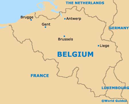
Map of Belgium
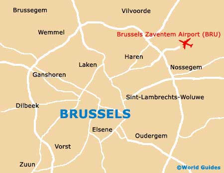
Map of Brussels