Port Douglas Maps and Orientation
(Port Douglas, Far North Queensland - QLD, Australia)
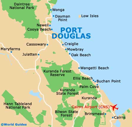
A popular resort town in Far North Queensland, Port Douglas stands just a short distance to the north of Cairns, part-way between Cooya Beach (north) and Oak Beach (south). Port Douglas serves as a convenient gateway to both the rainforest of the Daintree National Park and the world-famous Great Barrier Reef, and these two tourist attractions are jointly responsible for much of its current popularity.
The population of Port Douglas is slowly growing and there are now around 6,000 residents living here. However, during the peak season, between May and September, the overall population can easily more than double due to the seasonal influx of tourists.
Maps and Orientation of the City
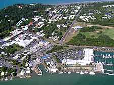
Port Douglas is easily reached along the Captain Cook Highway, with Davidson Street forming the main road as you enter the town. At the far end of Davidson Street is an intersection with Macrossan Street, with a bustling selection of shops lying to the left, and the scenic coastal Esplanade to the right, leading to Four Mile Beach.
The Port Douglas Visitor Centre is to be found along Macrossan Street and is a good source of tourist information, Queensland maps and details about reef cruises. Those with a car will find that excursions to the following destinations may be of interest:
- Atherton - 120 km / 75 miles (two hours, south)
- Babinda - 125 km / 78 miles (two hours, south)
- Bailey Creek - 62 km / 39 miles (one hour and 15 minutes, north)
- Brinsmead - 62 km / 39 miles (one hour and 15 minutes, south)
- Buchan Point - 41 km / 25 miles (50 minutes, south)
- Cairns - 67 km / 42 miles (one hour and 15 minutes, south)
- Cooya Beach - 19 km / 12 miles (25 minutes, north-west)
- Dayman Point - 32 km / 20 miles (35 minutes, north)
- Gordonvale - 90 km / 56 miles (one hour and 40 minutes, south)
- Hann Tableland National Park - 60 km / 37 miles (one hour and ten minutes, south)
- Herberton - 138 km / 86 miles (two hours and 15 minutes, south)
- Kuranda Forest Reserve - 92 km / 57 miles (one hour and 45 minutes, south)
- Mareeba - 95 km / 59 miles (one hour and 45 minutes, south)
- Mooroobool - 71 km / 44 miles (one hour and 20 minutes, south)
- Newell - 26 km / 16 miles (30 minutes, north)
- Oak Beach - 15 km / 9 miles (20 minutes, south)
- Palm Cove - 43 km / 27 miles (50 minutes, south)
- Thornton Beach - 71 km / 44 miles (one hour and 20 minutes, north)
- Wangetti Beach - 26 km / 16 miles (30 minutes, south)
- Wonga - 37 km / 23 miles (40 minutes, north)
- Yungaburra - 130 km / 81 miles (two hours and ten minutes, south)
Map of Australia

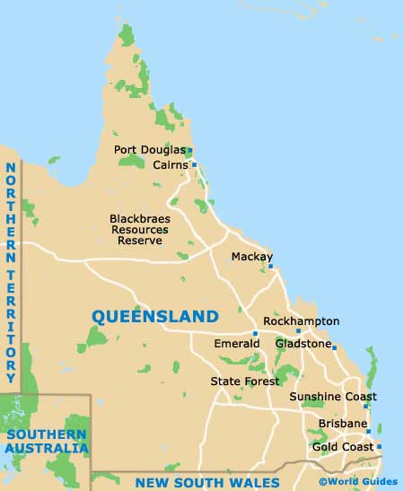
Map of Queensland
Map of Port Douglas