Singapore City Maps and Orientation
(Singapore City, Republic of Singapore)
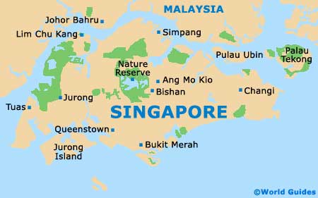
Singapore City sits at the southern end of the island of
Singapore, just off the tip of Peninsular Malaysia. The city-state is separated from
Malaysia by the narrow Straits of Johor and there are several islands in the chain.
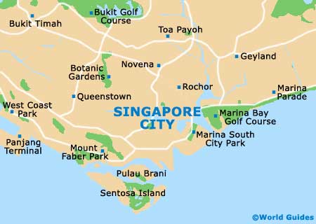
The touristy area lies right down in the south, around the mouth of the Singapore River, encompassing the colonial Historic District, Chinatown, Orchard Road, Kampong Glam and Little India. There are many more districts and the best bet is to get hold of a map for finding your way around.
Maps and Orientation of the City
While the country is small, Singapore City is actually sizeable and big enough to be considered too large to walk from one end to the other. The MRT subway, buses and taxis cover it really well, however. The Historic District resides on the north bank of the river, with Chinatown nearby, Orchard Road off to the north-west, and Little India to the east.
For Singapore maps, visit the tourist information office, check with your hotel, or buy online. Maps can be obtained at STB (Singapore Tourism Board) visitor centres, with walking tour maps of the city being especially popular.
- Bukit Timah - 13 km / 8 miles (20 minutes, north-west)
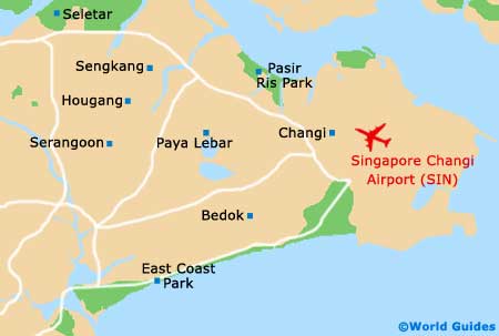
- Changi Airport - 21 km / 13 miles (25 minutes, north-east)
- East Coast Park - 8 km / 5 miles (15 minutes, east)
- Geylang - 8 km / 5 miles (15 minutes, north-east)
- Johor Bahru - 35 km / 22 miles (45 minutes, north)
- Jurong East - 17 km / 11 miles (20 minutes, west)
- Little India - 3 km / 2 miles (ten minutes, north)
- Night Safari - 23 km / 14 miles (30 minutes, north)
- Sentosa Island - 8 km / 5 miles (15 minutes, south-west)
- Serangoon - 13 km / 8 miles (20 minutes, north-east)
Map of Singapore
Map of Singapore City