New Delhi Maps and Orientation
(New Delhi, Delhi, India)
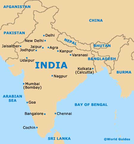
Located on the northern side of India, New Delhi was created by the British to be the country's imperial capital, with Old Delhi being the capital of Islamic India. Today, New Delhi remains the capital of the Republic of India and lies alongside one of the region's busiest transportation gateways.
There is no doubt that the Delhi area is large and extremely spread out. Within Old Delhi you will find the busy Inter State Bus Terminal (ISBT), while the New Delhi train station lies a little to the south. New Delhi is split into a number of notable neighbourhoods, with prominent business areas and residential districts. Connaught Place lies at the very heart of New Delhi and is an important local landmark and popular meeting place.
Maps and Orientation of the City
New Delhi stands within the Gangetic Plains and the Delhi Ridge, on the western side of the Yamuna River. One the eastern side of the river you will find the suburban Shahdara area, which contains a number of historic markets and some interesting architecture.
The India Tourism Delhi office on Connaught Place is a good place to obtain a map, with the fold-away Delhi map being especially popular and completely free of charge. Most bookshops around New Delhi sell more detailed maps of the area if required, particularly around Khan Market.
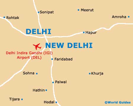
- Bulandshahr - south-east
- Faridabad - south
- Ghaziabad - north-east
- Gurgaon - south-west
- Hodal - south
- Khurja - south-east
- Meerut - north-east
- Moradabad - east
- Muzaffarnagar - north-east
- Panipat - north
- Rohtak - north-east
- Sonipat - north
Map of India
Map of New Delhi