Xiamen Maps and Orientation
(Xiamen, Fujian, China)
An influential regional port located on the south-eastern coastline of the People's Republic of China, the city of Xiamen has long been a major tourist destination. Known for its colonial atmosphere, organised city centre and beautiful countryside, central Xiamen is dominated by a number of modern skyscrapers, of which the China Construction Bank Building, International Plaza, Zhongmin Building, International Trade Building and the Minnan Hotel are amongst the tallest and most impressive.
The western waterfront district is a particularly attractive part of Xiamen and is sited opposite Gulang Yu, a small and rather peaceful island linked by regular a ferry service and boat trips. Xiamen island also stands nearby and is the home of Xiamen town, being linked to the mainland by a fairly narrow causeway, built in the mid-1950s and complete with road, railway line and pathway.
Maps and Orientation of the City
Xiamen is laid out in a logical structure, with the most prominent thoroughfares being located on the northern side of the city. The busy roads include the Xiahe Lu, the Hexiang Xilu, and the Hubin Nanlu, all of which run parallel to each other, in an east-west direction. Other notable roads around the very heart of Xiamen city centre include the Wenyuan Lu, the Huyuan Lu, the Gongyuan Xilu, the Zhongshan Lu and also the Zhenhai Lu.
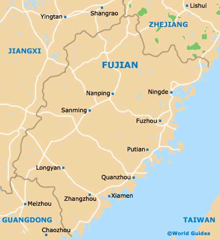
In close proximity to Xiamen you will find a number of cities, towns and villages worth exploring, the closest of which are listed below.
- Chaozhou - south-west
- Jimei - north
- Longyan - north-west
- Meizhou - west
- Putian - north-west
- Quanzhou - north-east
- Shantou - south-west
- Shishi - north-east
- Taipei (Taiwan) - east
- Zhangzhou - west
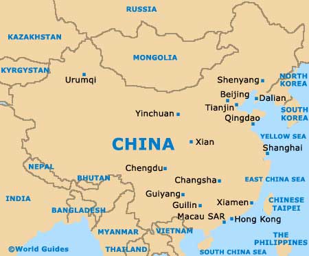
Map of China
Map of Fujian
Map of Xiamen

