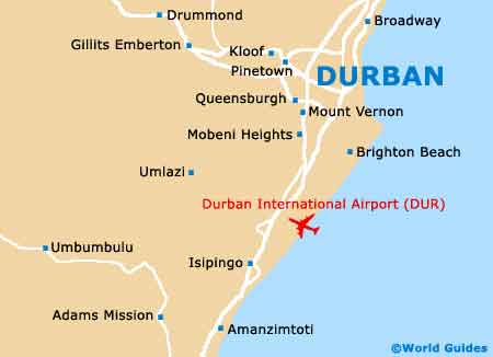
Durban Maps and Orientation
(Durban, KwaZulu-Natal, South Africa)
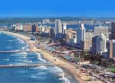
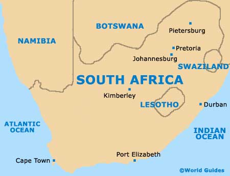
Located within the South African province of KwaZulu-Natal, where it has become the largest and most important city, Durban lies on the eastern shore and within the metropolitan municipality of eThekwini. Durban is home to the country's premier port and its superb beaches mean that the city has become something of a South African tourist hotspot.
The western suburbs of both Hillcrest and Kloof are noticeably elevated and stand at around 850 metres / 2,789 feet above sea level. Berea is another notable suburb of Durban and is located on a ridge, where it offers good views of the city centre.
Maps and Orientation of the City
The subtropical city of Durban is large and spreading, and there are certainly a number of different areas of particular interest to tourists. Marine Parade serves as an important focal point and stands alongside Durban's scenic beachfront, being lined with accommodation and entertainment venues, and always easy to pick out on most good city maps.
Other very popular parts of the city include both Greyville and Morningside, with many eateries and nightspots being based around the Florida area and along Windermere Road. West Street is a prominent thoroughfare in Durban and starts its life as a shopping mall, being close to the beachfront and the City Hall. To the north, the Umgeni River is an important boundary and is surrounded by spreading neighbourhoods, which lead to the resort of Umhlanga Rocks.
- Amanzimtoti - south
- Bloemfontein - north-west
- Cape Town - south-west
- East London - south-west
- Johannesburg - north-west
- Kokstad - south-west
- Ladysmith - north-west
- Lesotho - west
- Maseru - west
- Mbabane (Swaziland) - north
- Pietermaritzburg - north-west
- Port St. Johns - south-west
- Stanger - north
- Tongaat - north
- Umtata - south-west
- Umzinto - south
Continent Map of Africa

Map of South Africa
Map of Durban