Montpelier Maps and Orientation
(Montpelier, Vermont - VT, USA)
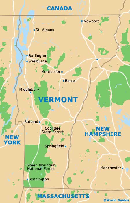
The state of Vermont lies on the far northeastern corner of North America, next to
Maine and
New Hampshire, and is where you will find the city of Montpelier, its capital city. Centrally located within Vermont, Montpelier also serves as the county seat for Washington County and surprisingly only has a population of just under 10,000 people.
The size of Montpelier makes this one of America's smallest state capitals and the fifth-largest city in Vermont, after Burlington, South Burlington, Rutland and Barre. However, the towns of Bennington, Brattleboro, Colchester, Essex and Hartford all also boast larger populations.
Central Montpelier is surrounded by a series of hills and ridges, being located just a short distance to the east of the Green Mountains. Towne Hill is a particularly notable natural landmark and resides on the northern side of the capital.
Maps and Orientation of the City
Downtown Montpelier itself is not a large place to explore, meaning that you can easily self-navigate with the help of a map, or by following the signposts. The Winooski River meanders its way along the southern side of downtown, with its tributaries creating small streams in different parts of the city.
Interstate I-89 is sited on the western outskirts, heading southwards to the Edward F. Knapp State Airport and northwestwards to Waterbury, Richmond, Williston and Burlington. Useful reference points in downtown Montpelier include the Vermont State House, the Hubbard Park Tower, the St. Augustine Cemetery and Vermont College.
- Barre - southeast
- Burlington - northwest
- Haverhill, New Hampshire (NH) - southeast
- Hinesburg - west
- Jericho - northwest
- Lake Champlain - northwest
- Middlebury - southwest
- Morristown - north
- Northfield - southwest
- Saint Johnsbury - northeast
- Shelburne - northeast
- Randolph - south
- Stowe Mountain Resort - northwest
- Waterbury - northwest
- Williston - northwest
Map of USA
Map of Vermont
Map of Montpelier
