Corpus Christi Maps and Orientation
(Corpus Christi, Texas - TX, USA)
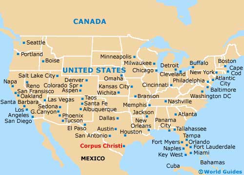
The southeastern coastline of Texas is where you will find the waterfront city of Corpus Christi. This sizeable city is a part of Nueces County, where it is the county seat. However, its boundaries actually extend into a number of surrounding counties, namely those of Aransas, Kleberg and San Patricio.
The city belongs to the Corpus Christi Metropolitan Statistical Area, where other prominent cities include Aransas Pass, Portland and Robstown, as well as the towns of Bishop, Ingleside, Mathis, Port Aransas, Rockport and Sinton.
Lake Corpus Christi is a prominent local landmark and is located just past the town of Mathis, being roughly 40 miles / 64 km to the northwest and connected by Interstate I-37. This enormous placid reservoir is fed by the Nueces River and is known for its plentiful recreational activities, which include swimming, water skiing, boating, hiking and also camping.
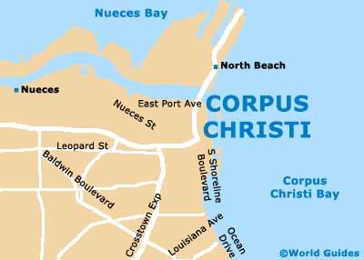
Maps and Orientation of the City
Getting around downtown Corpus Christi with maps should not present any problems. Prominent north to south thoroughfares include Carancahua Street, Chaparral Street, Mesquite Street, Staples Street and Tancahua Street. The Corpus Christi Cathedral is a handy local landmark to look out for if you lose your bearings.
The Shoreline Boulevard lines the coastline of Corpus Christi, linking marinas and the waterfront hotels, such as the Best Western Marina, the Super 8 Bayfront Hotel and the Omni Hotel Marina Tower. To the north, the Harbor Bridge connects with the Nueces Bay Causeway (US-181), while to the far southeast, the John F. Kennedy Memorial Causeway (SH-358) links Padre Island - the longest barrier island on the planet.
- Alice - 45 miles / 72 km (one hour and ten minutes, west)
- Aransas Pass - 20 miles / 32 km (35 minutes, northeast)
- Austin - 210 miles / 338 km (five hours, northwest)
- Banquete - 27 miles / 43 km (40 minutes, west)
- Bishop - 35 miles / 56 km (55 minutes, southwest)
- Calallen - 15 miles / 24 km (25 minutes, west)
- Gregory - 11 miles / 18 km (20 minutes, northeast)
- Ingleside - 17 miles / 27 km (30 minutes, northeast)
- Kingsville - 41 miles / 66 km (one hour and five minutes, southwest)
- Mathis - 38 miles / 61 km (one hour, northwest)
- Mustang Island State Park - 26 miles / 42 km (40 minutes, east)
- Orange Grove - 48 miles / 77 km (one hour and 15 minutes, northwest)
- Portland - 8 miles / 13 km (15 minutes, northeast)
- Robstown - 18 miles / 29 km (30 minutes, west)
- Rockport - 30 miles / 48 km (50 minutes, northeast)
- Sinton - 27 miles / 43 km (40 minutes, northwest)
- Welder Wildlife Foundation Park - 30 miles / 48 km (50 minutes, north)
Map of the United States
Map of Texas

Map of Corpus Christi