Memphis Maps and Orientation
(Memphis, Tennessee - TN, USA)
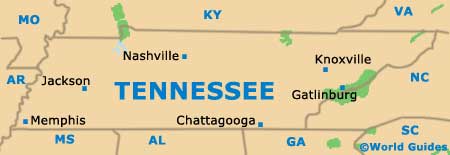
The famous music city of Memphis is tucked away in the far southwestern corner of Tennessee state, within Shelby County, where it is the county seat. Memphis stands alongside the point where the Mississippi River meets with the Wolf River, close to the state borders of
Arkansas and
Mississippi.
Beale Street (between 2nd Street and 4th Street) is where it all happens in Memphis, being packed with bars, eateries, shops and nightspots. This part of the city is a very pleasant and appealing place to walk around, soaking up the atmosphere.
Away from downtown Memphis and its plentiful tourist attractions, the city takes on an altogether more rundown appearance, with small houses, empty factories and areas of poverty. However, not all neighborhoods appear this way and many are much more uptogether, thanks to tireless regeneration work.
Maps and Orientation of the City
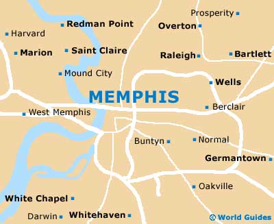
Downtown Memphis is certainly not difficult to navigate, with its streets being organized in an orderly fashion, named and numbered. The North Danny Thomas Boulevard (SR-1) is especially prominent, being located on the western side of the city center and connecting north with south. Further west, the Dr. Martin Luther King Jr. Expressway (Interstate I-69) also runs in this direction, joining the I-40 (north) and the I-55 (south).
For maps of Memphis, shops, gas stations and your hotel should all be able to help. Alternatively, either the Memphis Visitor Center on the Elvis Presley Boulevard or the Tennessee State Welcome Center on the North Riverside Drive are safe bets.
- Bartlett - 13 miles / 21 km (25 minutes, northeast)
- Collierville - 31 miles / 50 km (50 minutes, southeast)
- Frayser - 4 miles / 6 km (ten minutes, north)
- Germantown - 21 miles / 34 km (35 minutes, east)
- Hernando - 25 miles / 40 km (40 minutes, south)
- Hughes - 36 miles / 58 km (55 minutes, southwest)
- Marion - 12 miles / 19 km (20 minutes, northwest)
- Meeman Shelby Forest State Park - 15 miles / 24 km (25 minutes, north)
- Millington - 17 miles / 27 km (30 minutes, northeast)
- Olive Branch - 23 miles / 37 km (35 minutes, southeast)
- Shelby Farms Park - 17 miles / 27 km (30 minutes, east)
- Southaven - 14 miles / 23 km (25 minutes, south)
- T.O. Fuller State Park - 10 miles / 16 km (20 minutes, southwest)
- Walls - 16 miles / 26 km (30 minutes, southwest)
- Whitehaven - 11 miles / 18 km (20 minutes, south)
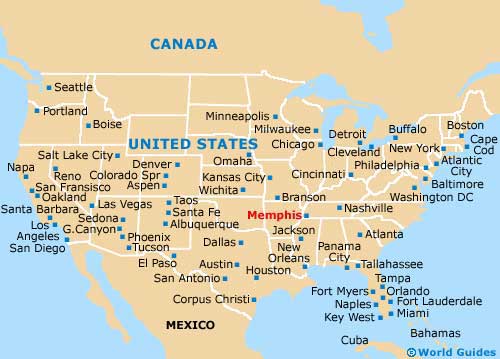
Map of the United States
Map of Tennessee
Map of Memphis