Tulsa Maps and Orientation
(Tulsa, Oklahoma - OK, USA)
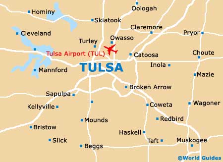
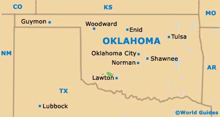
Lying in the northeastern quadrant of Oklahoma and functioning as the county seat for Tulsa County, the city of Tulsa is the state's most densely populated. However, the state capital of
Oklahoma City is actually considerably larger in overall terms of size and total population, being located some 105 miles / 169 km to the southwest and connected by the Interstate I-44.
The city resides between Ozarks Mountain Country and the Great Plains, with its boundaries spreading as far as the neighboring counties of Osage, Wagoner and Rogers.
Tulsa is often described as being a gateway into the 'Green Country' and enjoys a healthy tourism scene. The downtown district and its noticeable Art Deco character is especially appealing, with notable highlights including the Boston Avenue Methodist Church and also the Philcade Building, both of which enjoy a listing on the Tulsa Preservation Commission's National Register of Historic Places.
Maps and Orientation of the City
Maps of the city are useful for those planning a few days' worth of sightseeing and can be obtained from the Visitors Center at the William Center Tower II on West 2nd Street (Suite 150).
This outlet is easy to find, being close to the Tulsa Performing Arts Center and the City Hall, as well as the Hyatt Regency Hotel.
- Bixby - 22 miles / 35 km (35 minutes, southeast)
- Broken Arrow - 15 miles / 24 km (25 minutes, southeast)
- Catoosa - 15 miles / 24 km (25 minutes, east)
- Collinsville - 23 miles / 37 km (40 minutes, northeast)
- Glenpool - 15 miles / 24 km (25 minutes, south)
- Lynn Lane - 14 miles / 23 km (25 minutes, east)
- McKinley - 6 miles / 10 km (12 minutes, east)
- Mohawk Park - 8 miles / 13 km (15 minutes, northeast)
- Oakhurst - 8 miles / 13 km (15 minutes, southwest)
- Owasso - 13 miles / 21 km (25 minutes, northeast)
- Sand Springs - 8 miles / 13 km (15 minutes, west)
- Sapulpa - 14 miles / 23 km (25 minutes, southwest)
- Skiatook - 21 miles / 34 km (35 minutes, north)
- South Peoria - 6 miles / 10 km (12 minutes, south)
- Turley - 9 miles / 14 km (15 minutes, north)
- Valleyview - 7 miles / 11 km (15 minutes, north)
- West O'Main - 4 miles / 6 km (ten minutes, west)
Map of the United States

Map of Oklahoma
Map of Tulsa