Branson Maps and Orientation
(Branson, Missouri - MO, USA)
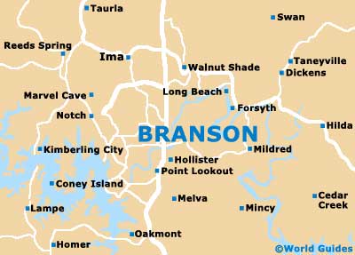
A cheery, friendly and relatively small city, Branson has lots of tourist appeal, with its wealth of entertainment venues and neon strip (Highway 76). Branson is located within Taney County and lies on the southwestern side of Missouri, close to the
Arkansas border.
The downtown district actually resides on the eastern side of the city and away from the geographical city center, next to the White River and Lake Taneycomo. On the western side of the city is the ever-popular Branson Theater District, which is connected to downtown via West Main Street and the West 76 Country Boulevard.
Camping is a big thing in Branson and each year, thousands of eager campers head to the surrounding campsites, often with their giant RVs. During the busy summer and fall seasons, the roads are often laden with traffic, meaning that getting about the city is often faster on foot than by car.
Maps and Orientation of the City
For city maps, bookstores can be found along roads such as the Branson Hills Parkway, the West 76 Country Boulevard and the Shepherd of the Hills Expressway.
Alternatively, head to the Branson Lakes Area Convention and Visitors Bureau (Lakes Area Chamber of Commerce), which is located on the junction of Highway 248 / Highway US-65, to the northwest of the downtown district.
- Cassville - 49 miles / 79 km (one hour and 20 minutes, west)
- Forsyth - 12 miles / 19 km (20 minutes, northeast)
- Harrison - 42 miles / 68 km (one hour and five minutes, south)
- Highlandville - 25 miles / 40 km (40 minutes, north)
- Hollister - 3 miles / 5 km (five minutes, south)
- Joplin - 112 miles / 180 km (two hours and 30 minutes, northwest)
- Kimberling City - 18 miles / 29 km (30 minutes, west)
- Melva - 7 miles / 11 km (12 minutes, south)
- Merriam Woods - 11 miles / 18 km (20 minutes, northeast)
- Ozark - 29 miles / 47 km (45 minutes, north)
- Ozark Plateau - 45 miles / 72 km (one hour and 15 minutes, east)
- Point Lookout - 4 miles / 6 km (ten minutes, south)
- Shell Knob - 40 miles / 64 km (one hour and five minutes, west)
- Springfield - 45 miles / 72 km (one hour and 15 minutes, north)
- Taneyville - 19 miles / 31 km (35 minutes, northeast)
Map of the United States
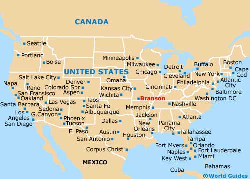
Map of Missouri

Map of Branson