Sedona Maps and Orientation
(Sedona, Arizona - AZ, USA)
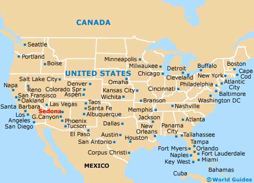
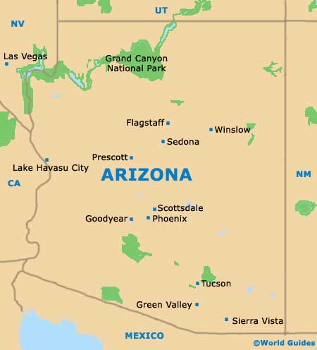
The small city of Sedona lies on the northern side of central Arizona, within the Upper Sonoran Desert area. The city is to be found directly to the north of both
Scottsdale and
Phoenix, and south of
Flagstaff and the Grand Canyon.
Sedona belongs to two different counties - Coconino County and Yavapai County. It is the county seat of Coconino, while in Yavapai, that honor belongs to the larger city of Prescott.
Since there is so much beautiful scenery to enjoy around Sedona, it makes sense to rent a vehicle and self-navigate, using maps to find your way to Highway 89A and the Oak Creek Canyon. The Slide Rock State Park is well-worth looking out for in this area. Guided tours of the Red Rocks are also available, in luxury buses and vans, while tours can also be personalized for an additional charge.
Maps and Orientation of the City
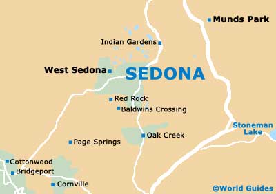
If you are planning a vacation of excursions, then pay a visit to the Sedona Chamber of Commerce Visitors Center, which is located on the corner of Forest Road and Highway 89A.
The Sedona Visitors Center is virtually encircled by red mountainous backdrops and stands close to the Pink Java Cafe, the Mago Cafe and the Southwest Photography Gallery.
- Agua Fria National Monument - 61 miles / 98 km (one hour and 30 minutes, south)
- Black Canyon City - 71 miles / 114 km (one hour and 40 minutes, south)
- Chino Valley - 64 miles / 103 km (one hour and 30 minutes, west)
- Cornville - 21 miles / 34 km (30 minutes, southwest)
- Cottonwood - 21 miles / 34 km (30 minutes, southwest)
- Dewey Humboldt - 52 miles / 84 km (one hour and 15 minutes, southwest)
- Flagstaff - 31 miles / 50 km (45 minutes, north)
- Grand Canyon Village - 108 miles / 174 km (two hours and 40 minutes, north)
- Mayer - 60 miles / 97 km (one hour and 30 minutes, southwest)
- Mesa - 132 miles / 212 km (three hours and 15 minutes, south)
- Payson - 87 miles / 140 km (two hours and five minutes, southeast)
- Phoenix - 116 miles / 187 km (three hours, south)
- Prescott Valley - 59 miles / 95 km (one hour and 25 minutes, southwest)
- Scottsdale - 125 miles / 201 km (three hours, south)
- Tempe - 125 miles / 201 km (three hours, south)
- Wilhoit - 83 miles / 134 km (two hours, southwest)
- Williamson - 66 miles / 106 km (one hour and 35 minutes, west)
- Winslow - 85 miles / 137 km (two hours and five minutes, northeast)
Map of the United States
Map of Arizona
Map of Sedona