Piura Maps and Orientation
(Piura, Peru)
Located on the north-western side of
Peru, close to Paita, Sullana and the Pacific coastline, the city of Piura lies within the region and province of the same name, where it has long been the capital. With a population of around 350,000 Peruvians, Piura has a rich history and strong colonial legacy, and dates back almost 500 years.
With the addition of much irrigation, Piura has become a leading centre of agriculture, in spite of its arid, desert setting. This thriving agricultural industry contrasts greatly with the coastal oil field situated within the neighbouring Talara area.
Maps and Orientation of the City
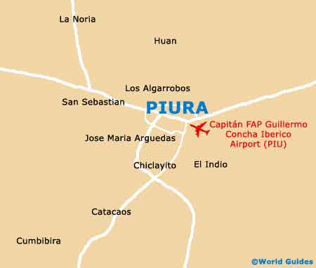
Piura is a very structured city, emanating outwards from its busy Plaza de Armas, which is very much central to local life. On the southern side of the Plaza de Armas, the Centro de Promocion Turistico is a well-placed tourist office and good source of maps. Head to the east and you will soon reach the Plaza Pizarro, and also the Rio Piura, a meandering river, which runs roughly in a north-south direction.
- Cajamarca - south-east
- Catacaos - south-west
- Chachapoyas - south-east
- Chiclayo - south
- Loja (Ecuador) - north-east
- Moyobamba - south-east
- Pacasmayo - north
- Paita - west
- Reserva Ecologica Chaparri - south-east
- Sullana - north
- Talara - north-west
- Trujillo - south
- Tumbes - north
- Tucume - south-east
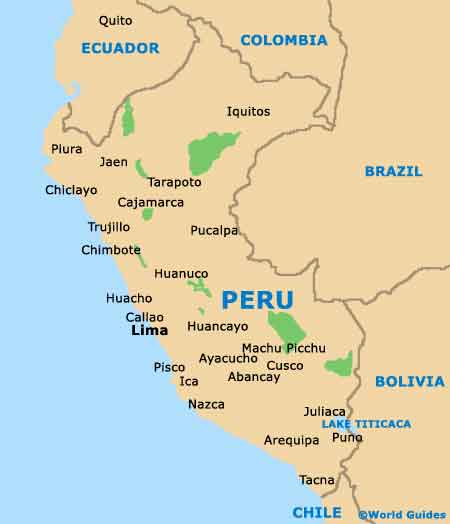
Map of Peru
Map of Piura