Cusco Maps and Orientation
(Cusco / Cuzco, Peru)
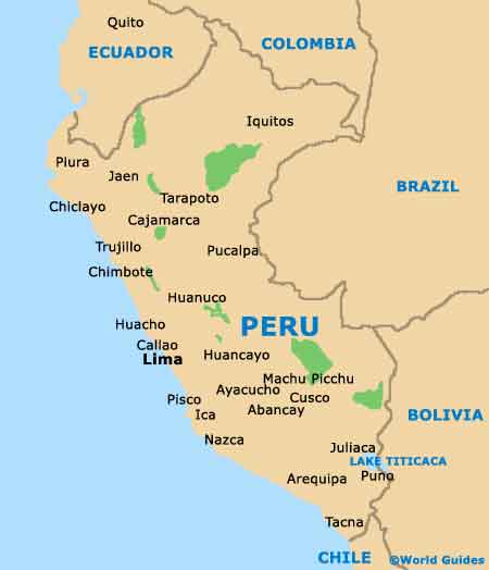
The magnetic and enticing tourist city of Cusco is situated within the south-eastern area of
Peru, close to the Andes mountains and also to the Sacred Valley, which is also known locally as the Urubamba Valley. This popular city lies within the Southern Sierras and is to be found at the eastern side of the Knot of Cusco.
Cusco is conveniently near to Ausangate, Paucatambo, the Rio Apurimac, the Rio Tambopata and the ancient, world-famous Inca site of Machu Picchu. Today, around 350,000 people now call this busy city their home and are joined by thousands of visitors each year.
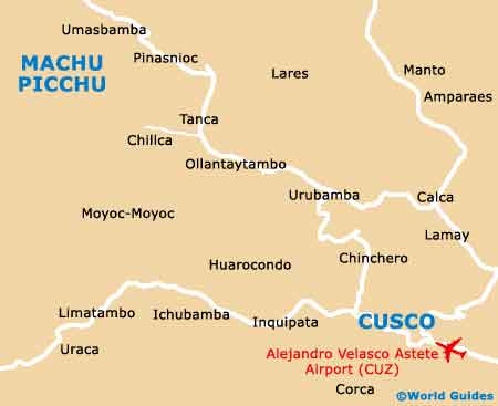
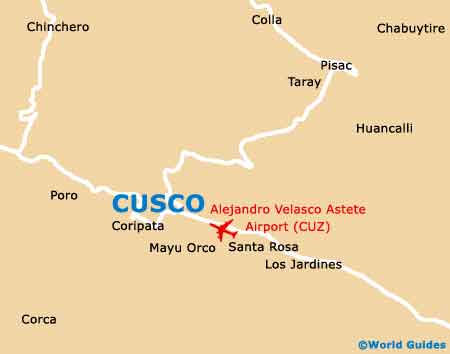
Maps and Orientation of the City
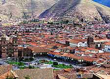
In recent years, Cusco has expanded greatly to meet its growing tourism needs, although it does successfully manage to retain a strong historical character, with cobbled alleys and giant Inca-built walls. At the very centre of Cusco, the Plaza de Armas is a prominent place of reference, while close by, the Avenida El Sol serves as the main thoroughfare and is known for its frequent traffic jams.
The Plaza de Armas is always a convenient point of reference and is just a short stroll from where you will find the Cusco Tourist Office - a good source for maps. A series of ancient winding streets stand directly to the north and east of the Plaza de Armas, while to the south and west is an expanse of green land.
- Abancay - west
- Arequipa - south
- Ayacucho - west
- Calca - north
- Chinchero - north
- El Misti - south
- Huancavelica - west
- Huanta - west
- Juliaca - south
- Lake Titicaca - south-east
- Machu Picchu - north-west
- Moray - north-west
- Parque Nacional Manu - north
- Pisac - north-east
- Pukapukara - east
- Puno - south
- Ollantaytambo - north-west
- Quillabamba - north
- Salinas - north-west
- Tarabamba - north-west
Map of Peru
Map of Cusco