Arequipa Maps and Orientation
(Arequipa, Peru)
Close to the Peruvian cities of Juliaca and Puno, Arequipa lies on the far southern side of
Peru, close to the borders with Bolivia and Chile. With the number of residents now exceeding 750,000 people, Arequipa has become Peru's number two city in terms of importance and overall population, after only the capital of
Lima, and the number three city when it comes to tourism, being behind both Lima and
Cusco, the latter of which is close to
Machu Picchu.
Arequipa is to be found alongside the Peruvian Altiplano area of the Andes and stands some 2,400 metres / 7,875 feet above sea level, being very much overlooked by the imposing El Misti volcano, which also goes by the name of the Guagua-Putina.
Maps and Orientation of the City
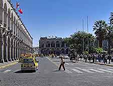
Central Arequipa is a large urban area filled with Spanish-style buildings constructed from white volcanic rock, and is relatively easy to find your way around on foot. However, since the street names seem to change every few blocks or so, maps are always a good idea. Maps are available from most hotels and also at the local tourist office, which is to be found on the Plaza de Armas. Close by, the districts of Cayma and Yanahuara are particularly appealing and within easy walking distance of Arequipa city centre.
Playing an integral part of life in Arequipa, the Plaza de Armas forms the very heart of the city and serves as a convenient meeting space for many, being surrounded by numerous hotels and places of interest. A number of prominent thoroughfares converge on the Plaza de Armas, such as the Mercaderes, the Santo Domingo and the Puente Bolognesi bridge, being organised in a checkerboard structure thereafter.
- Aplao - west
- Arica - south-east
- Azángaro - north-east
- Camana - west
- Canon del Colca - north
- Chivay - north
- Desaguadero - east
- Ilo - south
- Juliaca - north-east
- Lagunillas - north-east
- Lampa - north-east
- Matarani - south-west
- Mollendo - south
- Moquegua - south
- Picchu Picchu - east
- Puno - north-east
- Rio Majes - north
- Tacna - south-east
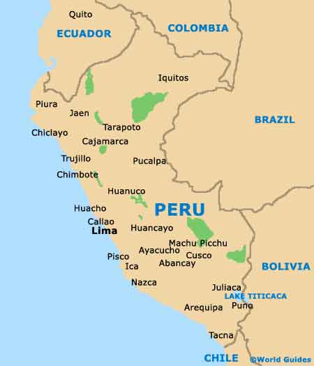
Map of Peru
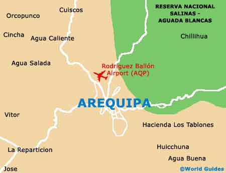
Map of Arequipa