Bursa Maps and Orientation
(Bursa, Turkey)
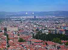
Located within the north-western side of Turkey and especially close to the Sea of Marmara, the city of Bursa stands next to Mount Uludag and was actually once the early capital of the famous Ottoman Empire. Bursa is situated within Turkey's Marmara region, where it is home to a population of more than one and a half million people.
The most important square in central Bursa is named the Cumhuriyet Alani, usually being better known to tourists as the Republic Square or simply the 'Heykel' (Statue), since it is presided over by a very prominent monument to Mustafa Kemal Ataturk (1881 to 1938), the man who founded the Republic of Turkey.
Maps and Orientation of the City
On the western side of the Republic Square, the Ataturk Caddesi is a prominent thoroughfare and heads through Bursa city centre and towards the Great Mosque (Ulu Cami). Continue in a westerly direction and it won't be long until you reach the Zafer Plaza shopping complex, an eye-catching glass pyramid which really is quite hard to miss, and is therefore a useful point of reference.
On the eastern side of the Republic Square, the Setbasi Namazgah Caddesi heads across the Gok Stream, while to the north-west, the Ataturk Caddesi leads onto the Cemal Nadir Caddesi and ultimately to the neighbourhood of Cekirge, an appealing spa suburb filled with quality hotels. The Ataturk Caddesi is where you will find the Bursa tourist office, which serves as a reliable source of city maps.
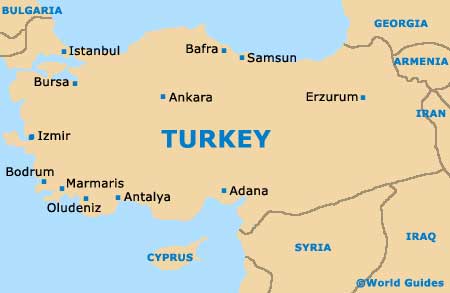
- Ankara - east
- Antalya - south
- Balikesir - south-west
- Bandirma - west
- Bodrum - south-west
- Bozuyuk - south-east
- Canakkale - west
- Esenyurt - north
- Eskisehir - south-east
- Gebze - north
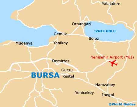
- Gemlik - north
- Inegol - south-east
- Istanbul - north
- Izmir - south-west
- Karacabey - west
- Kestel - east
- Kutahya - south-east
- Mudanya - north
- Orhaneli - south
- Orhangazi - north
- Tavsanli - south
- Usak - south
- Yalova - north
- Yenisehir - east
Map of Turkey
Map of Bursa