Antalya Maps and Orientation
(Antalya, Turkey)
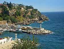
The Turkish city of Antalya lies on the south-westerly coastline of Turkey and next to the Mediterranean Sea, where it is home to almost 800,000 people. Located within the Antalya Province where it has become the capital city, Antalya stands high above the seafront, on top of a steep cliff.
Many scenic mountains surround the city and offer a particularly beautiful and natural backdrop on the north, east and west sides, while the Gulf of Antalya lies directly to the south. The city itself is based around a series of coastal plains, with the Kepezüstü Plain standing alongside the city centre and comprising an important residential area.
Maps and Orientation of the City
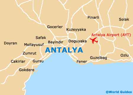
The main entrance into Antalya is via the 'gate of the city', which is better known locally as the 'Kalekapisi' and lies in the historical Old Quarter of Kaleici. Many tourists will find that the Kaleici district is the most appealing part of the city and its quays and harbour walls have all been recently restored, along with its imposing mosque. The Sarampol part of Kaleici is where you will find a good pedestrianised shopping area.
Trams fully encircle this part of Antalya and also travel along the actual seafront, linking the main places of interest and Turkish attractions. Head to the south and you will come upon the harbour, or to the west to reach the waterfront street of Cumhuriyet Caddesi, which leads to the Akdeniz Bulvari and ultimately the Konyaalti Beach. For maps of Antalya, look out for the tourist office on the Cumhuriyet Caddesi. Here you will find free city maps, although only a fairly limited offering of available accommodation leads.
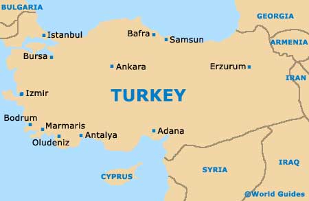
- Alanya - south-east
- Ankara - north-east
- Bodrum - west
- Burdur - north
- Cirali - south-west
- Denizli - north-west
- Fethiye - west
- Isparta - north
- Istanbul - north
- Izmir - north-west
- Karaman - east
- Kemer - south-west
- Konya - north-east
- Korkuteli - north-west
- Kumluca - south-west
- Manavgat - east
- Mersin - south-east
- Olimpos (Olympos) - south
- Patara - south-west
- Serik - east
- Seydisehir - north-east
- Side - east
- Termessos - north-west
Map of Turkey
Map of Antalya