Avila Maps
(Avila, Castilla y León, Spain)
Sited within the autonomous community of Castile and León, the city of Avila lies to the north-west of
Madrid, Spain's busy capital. Avila may be a small city, with a population of just over 30,000 (compared with Madrid's 3.2 million), but what it lacks in size in certainly makes up for in character.
This is not a difficult city to navigate and most will find that maps aren't really an essential item of luggage, since the Avila Catedral (Cathedral) and ancient City Walls (Las Murallas) certainly help you navigate and gain your bearings. Guided tours are also a useful exercise when you first arrive, particularly if you are intending to explore on foot, since that are a simple way of familiarising yourself with this city.
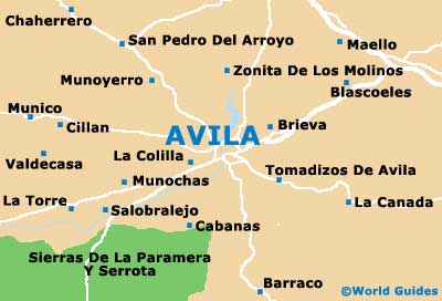
Maps and Orientation of the City
The historical Old Town of Avila radiates outwards in a westerly direction from the Catedral (on the Plaza de la Catedral), while those in need of public transport will find that both the bus station and railway station are just a short stroll away, in a north-easterly direction. For a good selection of hotels and fining dining, head to the easterly side of the Old Town.
Those who decide that a map of Avila would be sensible should head to the Tourist Office on the Plaza de la Catedral, open daily from 09:00 to 14:00 and 17:00 to 20:00.
- Albacete - 376 km / 234 miles (six hours, south-east)
- Alcobendas - 123 km / 76 miles (two hours and 15 minutes, east)
- Burgos - 260 km / 162 miles (four hours, north-east)
- Caceres - 233 km / 145 miles (three hours and 30 minutes, south-west)
- Ciudad Real - 319 km / 198 miles (five hours, south)
- Madrid - 112 km / 70 miles (one hour and 45 minutes, north-west)
- Manzanares - 291 km / 181 miles (four hours and 15 minutes, south-east)
- Medina del Campo - 87 km / 54 miles (one hour and 15 minutes, north)
- Palencia - 185 km / 115 miles (three hours, north)
- Salamanca - 106 km / 66 miles (one hour and 40 minutes, north-west)
- Segovia - 88 km / 55 miles (one hour and 15 minutes, north-east)
- Talavera de la Reina - 118 km / 73 miles (two hours, south)
- Toledo - 191 km / 119 miles (three hours and ten minutes, south-east)
- Valladolid - 140 km / 87 miles (two hours and 20 minutes, north)
- Zamora - 181 km / 112 miles (three hours, north-west)
Map of Spain

Map of Avila