Toledo Maps
(Toledo, Castile-La Mancha, Spain)
Within reasonable reach of
Madrid and
Avila, Toldeo is a relatively small city, with a population in the region of 45,000 residents. Toledo enjoys an elevated hilltop setting, meaning that there are often expansive views to be savoured at strategic vantage points.
The Tagus River flows down on three sides of the hill, with the city suburbs spreading further afield. Clearly defined and encompassed by the Casco Antiguo walls, the Old Town area is packed with character. Those using public transport will be able to find the bus station just a short distance to the north-east, and the railway station to the east, on the other side of the Tagus.
Maps and Orientation of the City
Old Town Toledo is centred around the Plaza de Zocodover, where accommodation and local Spanish eateries are in good supply. The Old Town is quite easy to find your way around, although if you are looking to travel outside and perhaps explore the Castilla La Mancha area of central Spain.
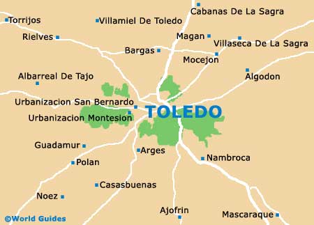
- Albarreal De Tajo - 24 km / 15 miles (40 minutes, north-west)
- Algodon - 51 km / 32 miles (one hour and ten minutes, north-east)
- Arges - 11 km / 7 miles (15 minutes, south)
- Avila - 191 km / 119 miles (three hours and ten minutes, north-west)
- Bargas - 15 km / 9 miles (25 minutes, north)
- Casasbuenas - 23 km / 14 miles (40 minutes, south-west)
- Guadamur - 17 km / 11 miles (30 minutes, south-west)
- Madrid - 90 km / 56 miles (one hour and 30 minutes, north)
- Magan - 17 km / 11 miles (30 minutes, north)
- Mascaraque - 32 km / 20 miles (50 minutes, south-east)
- Polan - 19 km / 12 miles (30 minutes, south-west)
- Rielves - 23 km / 14 miles (40 minutes, north-west)
- Torrijos - 33 km / 21 miles (50 minutes, north-west)
- Villamiel De Toledo - 21 km / 13 miles (35 minutes, north)
- Villaseca De La Sagra - 23 km / 14 miles (40 minutes, north-east)
Map of Spain

Map of Toledo