Warsaw Maps and Orientation
(Warsaw, Mazowieckie, Poland)
Standing within the province of Masovia and alongside the Vistula (Wisla) River, Warsaw is the biggest and most important city in the whole of Poland. With a population of around 1.8 million people, Warsaw has grown to become Poland's proud capital city and has undergone nothing short of a transformation over the past 30 years.
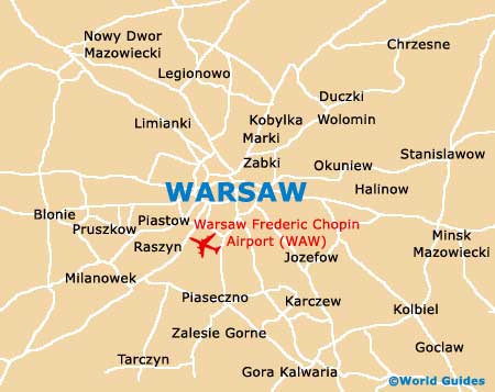
The Vistula River splits the city of Warsaw into two very distinct areas. Located on the westerly side of the river is where central Warsaw resides. The historic Old Town area can be found in this part of the city and has become a leading tourist attraction in its own right. On the eastern side of the Vistula, the Praga area is generally of less interest to tourists, although it is home to an increasing number of large hotels and apartments.
Maps and Orientation of the City
Much of Warsaw's western city centre is a very structured gridwork, with the most prominent thoroughfares heading in easterly and westerly directions. These include both the Al Jerozolimskie and also the Al Solidarnosci. Worth noting, the Ul Marszalkowska and the Ul Towarowa intersect these streets and run north to south. This gridwork encompasses the New Town area of Warsaw and also the financial city centre.
- Chynow - south
- Grodzisk Mazowiecki - south-west
- Legionowo - north
- Leszno - west
- Miasto - east
- Minsk Mazowiecki - east
- Nadbrzez - south
- Nowy Dwor Mazowiecki - north-west
- Otwock - south-east
- Piaseczno - south
- Pruszkow - south-west
- Serock - north
- Wieliszew - north
- Wolomin - north-east
- Wyszhow - north-east
- Zyrardow - south-west
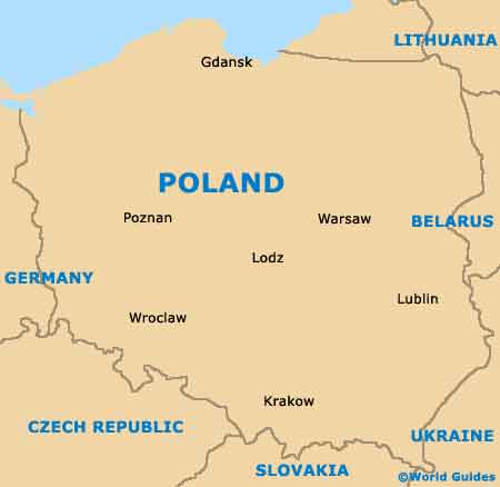
Map of Poland
Map of Warsaw