Corfu Maps and Orientation
(Corfu, Ionian Islands, Greece)
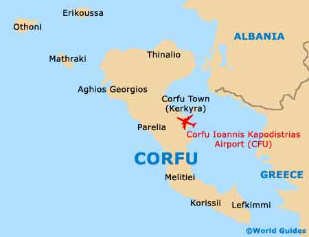
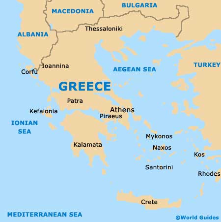
The second-biggest of the Greek Ionian Islands and one of the most popular with tourists, Corfu almost resembles the shape of a bent leg (with a little imagination) and lies on the western coast of Greece, within the Ionian Sea. Corfu can be found close to Sarande and the Albanian coastline, which is separated by a stretch of water which varies greatly in width.
Home to a population of just over 115,000 people, around 30,000 islanders live within Corfu Town, the capital. Corfu Town is situated on the eastern coast of the island's central section, and is divided into two main regions, north and south.
Maps and Orientation of the Island
The northern section of the town is where the historical Old Town district resides, between the New Fortress (Neo Frourio) and the Spianada. Take a stroll to the eastern side of Corfu Town and you will encounter the Old Fortress (Palaio Frourio), which is located next to the seafront and surrounded by a moat.
The southern area of Corfu Town is home to the New Town district, where the majority of shops and modern services are located. There is no actual official tourist office in the town, although a tourist kiosk often operates on the Plateia San Rocco and provides maps and brochures. Maps of the entire island are also generally available at hotels, free of charge.
The northern region of Corfu is fairly wide and rather mountainous, with a number of pleasant pebbly beaches, while the southern area generally features the most popular sandy beaches and resorts.
Map of Greece
Map of Corfu