Tartu Maps and Orientation
(Tartu, Tartumaa, Estonia)
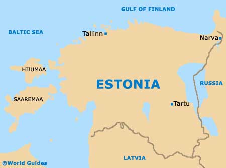
One of the biggest and most important of Estonia's cities, Tartu is located on the south-eastern side of the country. Tartu is extremely close to the eastern border of the Russian Federation and its Pskov area, while Latvia lies directly south of the city.
Located just less than 190 km / 118 miles north-west of Estonia's capital of
Tallinn, which can be reached in under three hours, Tartu has grown up around the Emajogi River. This winding river intersects the city and links Estonia's two biggest lakes.
Maps and Orientation of the City
One of the most important districts in central Tartu is based around the Cathedral Hill, which is known locally in Estonian as the Toomemägi. The majority of the city's most historical buildings are to be found between the Toomemägi and the Emajogi River.
The very heart of Tartu is the Town Hall Square (Raekoja Plats), around which you will find the biggest selection of hotels, restaurants and attractions. Close by are the busy shopping streets of Rüütli Tänav and Ulikooli Tänav, nearby to the university. Those looking for maps of Tartu should check out the University Bookshop (Ulikooli Raamatukauplus) the tourist office on the Raekoja Plats, on the travel agencies on the Vallikraavi Tänav and the Lossi Tänav.
- Elva - 26 km / 16 miles (30 minutes, south-west)
- Kanepi - 48 km / 30 miles (50 minutes, south)
- Luunja - 12 km / 7 miles (15 minutes, east)
- Narva - 180 km / 112 miles (two hours and 45 minutes, north-east)
- Noo - 16 km / 10 miles (20 minutes, south-west)
- Otepaa - 42 km / 26 miles (45 minutes, south-west)
- Palamuse - 41 km / 25 miles (45 minutes, north)
- Piirisaar - 50 km / 31 miles (55 minutes, east)
- Polva - 50 km / 31 miles (55 minutes, south)
- Puhja - 26 km / 16 miles (30 minutes, west)
- Rapina - 65 km / 40 miles (one hour and five minutes, south-east)
- Tabivere - 25 km / 16 miles (28 minutes, north)
- Tallinn - 189 km / 117 miles (two hours and 55 minutes, north-west)
- Ulenurme - 9 km / 6 miles (12 minutes, south)
- Voru - 70 km / 43 miles (one hour and 15 minutes, south)
Map of Estonia
Map of Tartu

