Stratford upon Avon Maps and Orientation
(Stratford upon Avon, Warwickshire, England, UK)
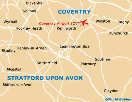
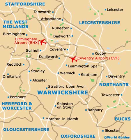
The historical town of Stratford upon Avon lies within the county of Warwickshire and alongside the winding River Avon. Stratford upon Avon is particularly close to Broadway,
Coventry and Warwick, and currently boasts a population rapidly approaching 25,000 residents.
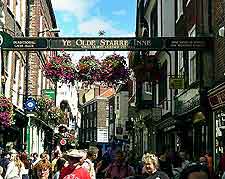
When you arrive by road or by rail, you will find yourself within easy walking distance of the very heart of Stratford upon Avon and its endless selection of Shakespeare-related attractions. The town centre is really best explored on foot, and public transport is likely only to be necessary for those planning to pay a visit to
Mary Arden's House in the neighbouring village of Wilmcote.
Maps and Orientation of the City
Located next to the river and on the Bridgefoot is the Stratford upon Avon Tourist Information Centre (TIC), where local maps can be picked up free of charge. The TIC houses all manner of tourist-related information, although do bear in mind that it can become extremely busy during the summer season, particularly at the weekends.
The Stratford upon Avon TIC is also a good place to join in regular guided tours of the town, which are always insightful and start here each Saturday morning (and also Sunday mornings between July and September).
- Banbury - 43 km / 27 miles (35 minutes, south-east)
- Birmingham - 62 km / 39 miles (45 minutes, north-west)
- Broadway - 24 km / 15 miles (30 minutes, south-west)
- Cheltenham - 50 km / 31 miles (55 minutes, south-west)
- Chipping Norton - 34 km / 21 miles (40 minutes, south)
- Coventry - 30 km / 19 miles (35 minutes, north-east)
- Gloucester - 67 km / 42 miles (one hour, south-west)
- Hinckley - 51 km / 32 miles (45 minutes, north-east)
- Kenilworth - 22 km / 14 miles (25 minutes, north-east)
- Kidderminster - 62 km / 39 miles (55 minutes, north-west)
- Leamington Spa - 18 km / 11 miles (20 minutes, north-east)
- Leicester - 72 km / 45 miles (one hour and five minutes, north-east)
- Lichfield - 71 km / 44 miles (one hour, north)
- Nuneaton - 45 km / 28 miles (45 minutes, north-east)
- Oxford - 85 km / 53 miles (one hour and 15 minutes, south-east)
- Solihull - 38 km / 24 miles (40 minutes, north)
- Stoke-on-Trent - 132 km / 82 miles (one hour and 40 minutes, north)
- Sutton Coldfield - 59 km / 37 miles (46 minutes, north)
- Walsall - 70 km / 44 miles (55 minutes, north)
- Warwick - 14 km / 9 miles (15 minutes, north-east)
- West Bromwich - 70 km / 44 miles (55 minutes, north)
- Wilmote - 4 km / 3 miles (ten minutes, north-west)
- Wixford - 11 km / 7 miles (15 minutes, west)
- Wolverhampton - 78 km / 49 miles (one hour and five minutes, north-west)
- Wootton Wawen - 7 km / 4 miles (15 minutes, north)
- Worcester - 40 km / 25 miles (45 minutes, west)
Map of the United Kingdom

Map of Warwickshire
Map of Stratford upon Avon