Sunderland Maps and Orientation
(Sunderland, Tyne and Wear, England, UK)
Located in north-easterly
England and within the metropolitan county of Tyne and Wear, Sunderland is a small city, with a population hovering just under the 300,000 mark. Sunderland only gained its actual city status relatively recently in 1992 and although it does not contain a cathedral as such, its minster is particularly grand and serves as the city's most important church.
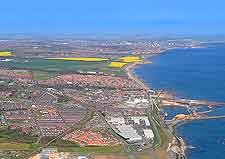
Much of Sunderland is situated along a relatively low stretch of hills, which stand alongside the shoreline. The River Wear divides the city into two main areas, with just under three quarters of the total population living on the southerly banks.
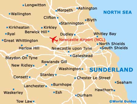
Maps and Orientation of the City
The surrounding towns of Chester Le Street and Houghton Le Spring are often referred to as being part of the city proper, along with a number of further settlements, such as Boldon, Fulwell, Hendon, Monkwearmouth and Ryhope.
From the eighties onwards, Sunderland has worked hard to create a new 21st-century city, with major regeneration plans being planned and successfully implemented. These projects are usually overseen by the Sunderland Arc company and areas such as Holmeside Triangle, Stadium Village, and Vaux and Farringdon Row, are all very much up-and-coming districts.
If you are intending to explore Sunderland and the adjoining coastline of the Roker and Seaburn areas, then maps are the best way to find your way around. Maps are available from the Sunderland Tourist Information Centre (TIC) on Fawcett Street.
- Alnwick - 74 km / 46 miles (one hour and 15 minutes, north)
- Ashington - 43 km / 27 miles (45 minutes, north)
- Bedlington - 35 km / 22 miles (40 minutes, north)
- Bishop Auckland - 40 km / 25 miles (45 minutes, south-west)
- Blyth - 38 km / 24 miles (40 minutes, north)
- Chester Le Street - 16 km / 10 miles (25 minutes, south-west)
- Cramlington - 30 km / 19 miles (35 minutes, north)
- Darlington - 50 km / 31 miles (50 minutes, south)
- Durham - 21 km / 13 miles (25 minutes, south-west)
- Harrogate - 115 km / 72 miles (one hour and 45 minutes, south)
- Hartlepool - 34 km / 21 miles (40 minutes, south)
- Houghton Le Spring - 10 km / 6 miles (15 minutes, south-west)
- Leeds - 144 km / 90 miles (two hours and five minutes, south)
- Middlesborough - 45 km / 28 miles (45 minutes, south)
- Newcastle upon Tyne - 22 km / 14 miles (30 minutes, north-west)
- Scarborough - 126 km / 79 miles (two hours and five minutes, south-east)
- Seaham - 10 km / 6 miles (15 minutes, south)
- Sheffield - 208 km / 129 miles (two hours and 35 minutes, south)
- South Shields - 13 km / 8 miles (20 minutes, north)
- Washington - 13 km / 8 miles (20 minutes, west)
- Whitby - 96 km / 60 miles (one hour and 35 minutes, south-east)
- Whitley Bay - 26 km / 16 miles (30 minutes, north)
- York - 118 km / 74 miles (one hour and 55 minutes, south)
Map of the United Kingdom

Map of Tyne and Wear

Map of Sunderland