Ipswich Maps and Orientation
(Ipswich, Suffolk, England, UK)
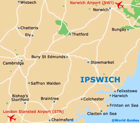
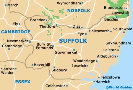
The town of Ipswich is located within the county of Suffolk, on the eastern side of
England, within the region of East Anglia. Ipswich is the county town and now has a population exceeding 130,000 people.
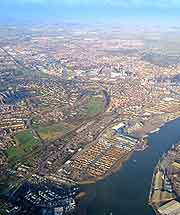
Based around the River Orwell and standing particularly close to both the ports of Felixstowe and Harwich, Ipswich has recently enjoyed much renovation work, with its waterfront area being the principal point of revitalisation. The docks are now very much a spot for leisure activities and yachting, and feature luxury quayside apartments, bars and restaurants, and even a new campus for the University of Suffolk. All of these buildings have been carefully planned to blend with existing architecture and structures, such as the Old Custom House.
Maps and Orientation of the Town
The docks are also home to a number of offices, with a major business park being found on the northern side of the river, where shiny towers contrast with more traditional Victorian houses. Also situated close to the Ipswich docks, Holywells Park is a spacious public parkland and an important place of recreation. Other prominent districts surrounding the town centre include Castle Hill, Gainsborough, Greenwich, Maidenhall, Priory Heath, Rose Hill, Warren Heath and Westbourne.
For maps of Ipswich, the Tourist Information Centre (TIC) is the best place to come, located off St. Stephen's lane and just a short walk from the bus station. The town's train station is to be found a little further afield, being around a 15-minute walk away and best reached along Princes Street.
- Aldeburgh - 42 km / 26 miles (45 minutes, north-east)
- Braintree - 53 km / 33 miles (50 minutes, south-west)
- Bury St. Edmunds - 43 km / 27 miles (45 minutes, north-west)
- Cambridge - 86 km / 54 miles (one hour and ten minutes, west)
- Chelmsford - 64 km / 40 miles (one hour, south-west)
- Clacton on Sea - 18 km / 11 miles (25 minutes, south)
- Colchester - 29 km / 18 miles (40 minutes, south-west)
- Felixstowe - 19 km / 12 miles (25 minutes, south-east)
- Frinton on Sea - 48 km / 30 miles (45 minutes, south)
- Harwich - 51 km / 32 miles (45 minutes, south-east)
- Leiston - 40 km / 25 miles (45 minutes, north-east)
- London - 123 km / 77 miles (one hour and 45 minutes, south-west)
- Manningtree - 18 km / 11 miles (25 minutes, south-west)
- Norwich - 69 km / 43 miles (one hour and five minutes, north)
- Peterborough - 141 km / 88 miles (one hour and 50 minutes, north-west)
- Pinebrook - 5 km / 3 miles (eight minutes, south-west)
- Southend on Sea - 93 km / 58 miles (one hour and 15 minutes, south)
- Stowmarket - 21 km / 13 miles (25 minutes, north-west)
- Sudbury - 34 km / 21 miles (40 minutes, west)
- Whitton - 5 km / 3 miles (eight minutes, north-west)
- Woodbridge - 14 km / 9 miles (20 minutes, east)
Map of the United Kingdom

Map of Suffolk
Map of Ipswich