Scarborough Maps and Orientation
(Scarborough, North Yorkshire, England, UK)
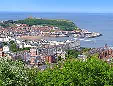
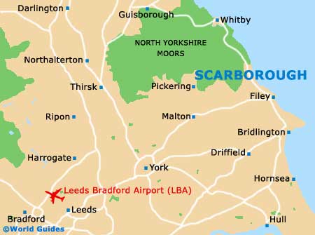
Located on the south-easterly edge of the North Yorkshire Moors and alongside the North Sea coastline, Scarborough is a modern town and popular seaside resort combined. Originally a fishing town, Scarborough was once centred around the historic Old Harbour, which is somewhat sheltered by a rocky headland.
The town's geography is particularly unusual, and the splendid castle ruins rather dominate the landscape, being perched up high on a promontory and overlooking the seafront, separating the North Bay from the South Bay. Much of the tourist scene in Scarborough is now focused around the redeveloped South Bay area, due to its sweeping sandy beach, seaside amusements and theatres.
Maps and Orientation of the Town
The more commercial centre of Scarborough now lies just a short distance to the north-west of the Old Harbour, on a high plateau, and is where you will find local transport, shops and nightspots. Generally more peaceful and quiet, the North Bay still offers a number of very worthwhile attractions, being home to Peasholm Park and its large boating lake, and still has its fair share of amusements, fish and chip shops, and seaside promenades.
To the south, Scarborough's appealing Victorian development is actually separated from the town centre by a deep valley, where it is connected by high bridges. Maps of the town can be useful if you are walking between attractions and are easy to come by.
- Beverley - 53 km / 33 miles (one hour and five minutes, south)
- Bradford - 136 km / 85 miles (two hours and ten minutes, south-west)
- Bridlington - 27 km / 17 miles (30 minutes, south-east)
- Darlington - 104 km / 65 miles (one hour and 45 minutes, north-west)
- Doncaster - 114 km / 71 miles (two hours, south-west)
- Driffield - 34 km / 21 miles (40 minutes, south-east)
- Filey - 11 km / 7 miles (15 minutes, south-east)
- Grimsby - 110 km / 69 miles (one hour and 50 minutes, south)
- Guisborough - 64 km / 40 miles (one hour and five minutes, north-west)
- Harrogate - 98 km / 61 miles (one hour and 35 minutes, south-west)
- Helmsley - 48 km / 30 miles (50 minutes, west)
- Hull - 74 km / 46 miles (one hour and 20 minutes, south)
- Leeds - 107 km / 67 miles (one hour and 45 minutes, south-west)
- Lincoln - 131 km / 82 miles (two hours and ten minutes, south)
- Malton - 37 km / 23 miles (40 minutes, south-west)
- Middlesborough - 77 km / 48 miles (one hour and 20 minutes, north-west)
- Newcastle upon Tyne - 144 km / 90 miles (two hours and 20 minutes, north-west)
- Pickering - 29 km / 18 miles (30 minutes, west)
- Rotherham - 134 km / 84 miles (two hours and ten minutes, south-west)
- Selby - 88 km / 55 miles (one hour and 25 minutes, south-west)
- Sheffield - 146 km / 91 miles (two hours and 15 minutes, south-west)
- Sunderland - 126 km / 79 miles (two hours, north-west)
- Whitby - 32 km / 20 miles (40 minutes, north-west)
- York - 67 km / 42 miles (one hour and 15 minutes, south-west)
Map of the United Kingdom

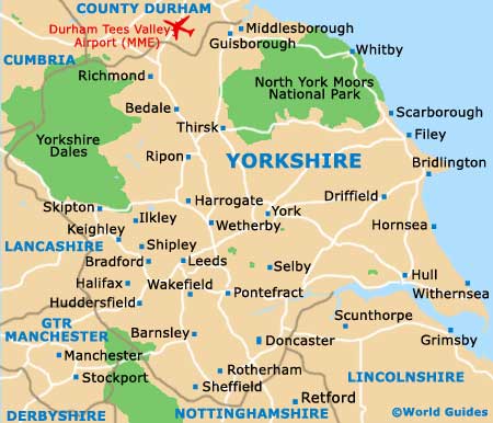
Map of Yorkshire
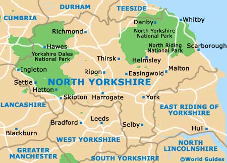
Map of North Yorkshire
Map of Scarborough