Canterbury Maps and Orientation
(Canterbury, Kent, England, UK)
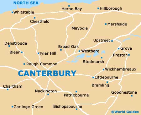
Located just 20 minutes south from the nearby coastline, the city of Canterbury is located within the spreading county of Kent, in south-east England. Canterbury is well connected to the area by a series of 'A' roads, which include the A2 between Faversham and Whitfield, and the A28 between Monkton and Ashford.
To the east of Canterbury, the M2 and M26 lead to London's famous ring motorway, the M25. Due to its proximity, London is a popular day trip with visitors staying in Canterbury and St. Pancras Station can now be reached in just under an hour.
Maps and Orientation of the City
Popular coastal towns and villages close to Canterbury include Herne Bay, Whitstable, Westgate On Sea and Birchington, which are all close to each other and located to the north-east. Also nearby are the up-and-coming towns of Margate and Ramsgate, which have a definite 'London' feel.
The main towns and villages close to Canterbury are as follows, with journey times depending upon road size, access and traffic:
- Ashford - 24 km / 15 miles (south-west, 25 minutes)
- Aylesham - 16 km / 10 miles (south-east, 15 minutes)
- Birchington - 24 km / 15 miles (north-east, 25 minutes)
- Chestfield - 10 km / 6 miles (north, 14 minutes)
- Deal - 37 km / 23 miles (east, 35 minutes)
- Dover - 29 km / 18 miles (south-east, 25 minutes)
- Faversham - 14 km / 9 miles (north-west, 15 minutes)
- Folkestone - 29 km / 18 miles (south, 30 minutes)
- Fordwich - 6 km / 4 miles (east, 10 minutes)
- Herne Bay - 14 km / 9 miles (north-east, 20 minutes)
- Hythe - 26 km / 16 miles (south, 27 minutes)
- London - 97 km / 60 miles (north-west, one hour and 15 minutes)
- Maidstone - 43 km / 27 miles (west, 35 minutes)
- Margate - 31 km / 19 miles (north-east, 32 minutes)
- Petham - 6 km / 4 miles (south, 8 minutes)
- Ramsgate - 31 km / 19 miles (north-east, 35 minutes)
- Sandwich - 23 km / 14 miles (east, 25 minutes)
- Westgate on Sea - 26 km / 16 miles (north-east, 30 minutes)
- Whitstable - 11 km / 7 miles (north, 18 minutes)
Map of the United Kingdom

Map of Kent

Map of Canterbury