Weymouth Maps and Orientation
(Weymouth, Dorset, England, UK)
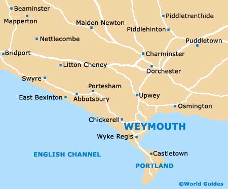
The popular seaside town of Weymouth has long been one of the highlights in this part of Dorset and regularly attracts large numbers of visitors during the summer months. Weymouth lies along England's southerly coast, on the eastern side of a small peninsula-like projection, and can be found directly south of nearby Dorchester, separated by the picturesque South Dorset Downs.
Weymouth enjoys a scenic bay setting and stands at the mouth of the meandering River Wey, on the shoreline of the English Channel. The biggest town in the region, Weymouth is a lively spot and a draw card for many locals living close by.
Maps and Orientation of the Town
The resort is considered part of the Weymouth and Portland borough, due to its proximity to the Isle of Portland. Located directly south of Weymouth, the Isle of Portland is approximately 6 km / 4 miles in length and just 2.5 km / 1.5 miles in width. Portland is famous for being home to its pebbly Chesil Beach, which links the mainland, and is easy to reach from Weymouth, being connected by the Portland Beach Road (A354).
The distance and direction from Weymouth to notable nearby cities, towns and villages are shown below. Journey times are calculated not only on distance, but also take into account the size and speed of the roads along the route.
- Bournemouth - 58 km / 36 miles (55 minutes, north-east)
- Charlestown - 3 km / 2 miles (5 minutes, west)
- Chickerell - 5 km / 3 miles (6 minutes, west)
- Christchurch - 77 km / 48 miles (one hour, north-east)
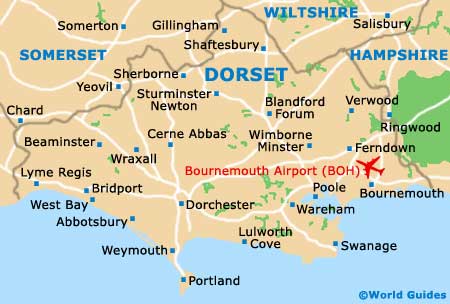
- Dorchester - 13 km / 8 miles (16 minutes, north)
- Exeter - 105 km / 65 miles (one hour and 20 minutes, west)
- Exmouth - 67 km / 60 miles (one hour and 15 minutes, west)
- Lyme Regis - 48 km / 30 miles (45 minutes, west)
- Overcombe - 5 km / 3 miles (7 minutes, north)
- Poole - 51 km / 32 miles (45 minutes, north-east)
- Portland - 10 km / 6 miles ( 15 minutes, south)
- Ringwood / New Forest - 64 km / 40 miles (55 minutes, north-east)
- Salisbury - 77 km / 48 miles (one hour and 10 minutes, north-east)
- Southampton - 100 km / 62 miles (one hour and 15 minutes, north-east)
- Swanage - 45 km / 28 miles (50 minutes, east)
- Taunton - 87 km / 54 miles (one hour and 15 minutes, north-west)
- Yeovil - 47 km / 29 miles (45 minutes, north)
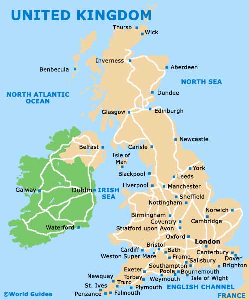
Map of the United Kingdom
Map of Dorset
Map of Weymouth