Dubrovnik Maps and Orientation
(Dubrovnik, Southern Dalmatia, Croatia)
The ancient city of Dubrovnik and its harbour lies on a peninsula on the Adriatic seacoast, in the far southern region of
Croatia, close to Bosnia-Herzegovina and Montenegro. Backing the coastal plain are the Dubrovnik Highlands, a rough, rocky pine-clad region, home to many species of birds and wildlife.
The narrow coastal strip on which Dubrovnik resides is mainly agricultural, set back from the rocky coastlines and small bays. Croatia has many natural lakes, both inland and on its many islands, all varying in colour from azure blue to green and grey.
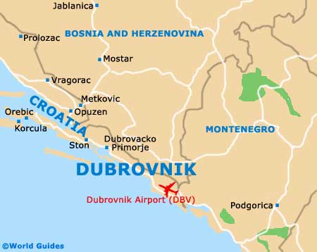
Maps and Orientation of the City
The city of Dubrovnik, with its defensive rocky promontory and sheltered harbour, is set on the farthest southern corner of Croatia. Home to around 50,000 people, the heart of the city is the long promenade known as the Stradun, which runs from end to end of the enclosed Old City.
The historic quarter is home to most of the sites of interest, museums and shopping areas, and is totally pedestrianised. Tiny, marble-paved streets and alleys run at right angles to the Stradun, crammed with little shops and boutiques. To the right of the harbour rises the vast rock on which the city's spectacular main fortress perches, built of white stone and now a famous theatre, as well as a historic monument. City maps can be found at the local tourist offices, located at the bus station, Gruz Harbour, the Pile Gate, in the Lapad area, and on the Old City's Ulica Svetog Dominika.
- Herceg Novi (Montenegro) - 45 km / 28 miles (55 minutes, south-east)
- Konavle - 18 km / 11 miles (25 minutes, south-east)
- Ljubinje - 12 km / 7 miles (15 minutes, north)
- Makarska - 178 km / 111 miles (three hours and 25 minutes, north-west)
- Metkovic - 147 km / 92 miles (two hours and 50 minutes, north-west)
- Opuzen - 139 km / 87 miles (two hours and 40 minutes, north-west)
- Podstrana - 246 km / 154 miles (four hours and 15 minutes, north-west)
- Split - 260 km / 162 miles (four hours and ten minutes, north-west)
- Vrgorac - 155 km / 97 miles (three hours, north-west)
- Zagreb - 632 km / 395 miles (seven hours and 30 minutes, north)
- Zaton - 14 km / 9 miles (20 minutes, north-west)
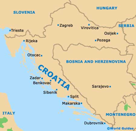
Map of Croatia
Map of Dubrovnik