Innsbruck Maps and Orientation
(Innsbruck, Tyrol, Austria)
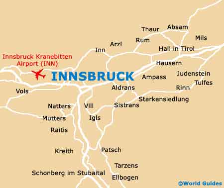
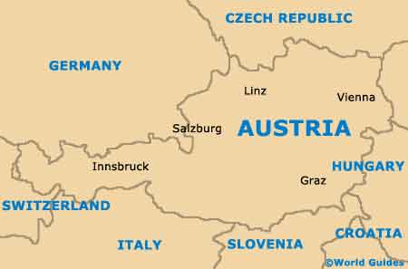
Located on the western side of Austria and sandwiched by both the German border (north) and the Italian border (south), Innsbruck lies within the state of Tyrol, where it is the proud capital. Innsbruck enjoys an especially scenic situation, within the valley of the River Inn, being conveniently near to the Alps (north) and the Tuxer Mountains (south).
The historical heart of Innsbruck is made up of both the Inner City (Innere Stadt) and also the Old Town (Altstadt). The charming streets are ideal to stroll around and home to a number of notable local landmarks, such as the Hofkirche Innsbruck (Universitätsstrasse) and the Kaiserliche Hofburg Innsbruck (Rennweg).
Maps and Orientation of the City
Central Innsbruck is quite compact and easy to find your way around, although maps are always helpful. The centre of the Old Town is fully pedestrianised and completely traffic free, and just a short stroll from the main railway station, known locally as the Hauptbahnhof. Worth noting, the main thoroughfare in Old Town Innsbruck is the Herzog Friedrich Strasse.
Maps of Innsbruck can be found at the city's main tourist office, which is located on the Burggraben. You will also be able to obtains maps of Innsbruck at the tourist counter at the Hauptbahnhof, which stands on the station's Lower Concourse.
- Ampass - 8 km / 5 miles (12 minutes, east)
- Bludenz - 134 km / 83 miles (one hour and 45 minutes, west)
- Imst - 59 km / 37 miles (one hour, west)
- Kematen in Tirol - 13 km / 8 miles (15 minutes, west)
- Kitzbuhel - 92 km / 57 miles (one hour and 30 minutes, north-east)
- Mittersill - 121 km / 75 miles (one hour and 40 minutes, east)
- Munich (Germany) - 164 km / 102 miles (one hour and 50 minutes, north)
- Salzburg - 185 km / 115 miles (two hour and ten minutes, north-east)
- Schwaz - 31 km / 19 miles (35 minutes, east)
- Telfs - 28 km / 17 miles (30 minutes, west)
- Unterperfuss - 14 km / 9 miles (18 minutes, west)
- Vols - 6 km / 4 miles (ten minutes, west)
- Wattens - 18 km / 11 miles (25 minutes, east)
- Winterthur (Switzerland) - 264 km / 164 miles (three hours, west)
- Zurich (Switzerland) - 290 km / 180 miles (three hours and 15 minutes, west)
Map of Austria
Map of Innsbruck