Milford Sound Maps and Orientation
(Milford Sound, South Island, New Zealand)

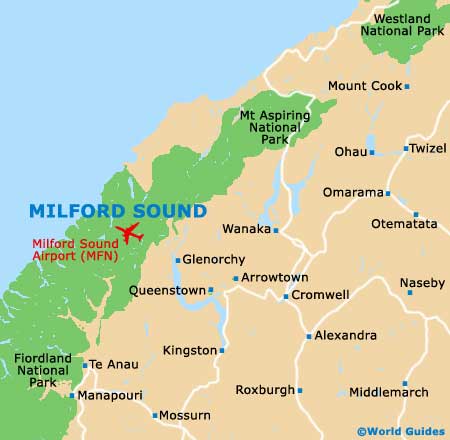
Milford Sound lies at the top centre of Fiordland National Park on maps, about 20 km / 12 miles from the Tasman Sea. This is the south-west of the South Island - West of Wanaka and north-west of
Queenstown. Te Anau is to be found roughly 120 km / 75 miles due south of the Sound.
If you consider the shape of a diamond, Wanaka is at the top point, Te Anau at the bottom and Queenstown on the right, with Milford Sound being sited roughly at the west point. It is served directly from Te Anau by the Milford Sound Highway, which usually shows as Highway 94 on maps.
Maps and Orientation of the Area
The township of Milford Sound itself is tiny and not worth mentioning. The business end of the Sound is the airport and the cruise pier, which are both within close proximity of one another on the water's edge. Highway 94 terminates at this point.
For Milford Sound maps, the best bet is to visit the Fiordland National Park Visitor Centre in Te Anau, which has free maps of the area. It is open daily and located on the Lakefront Drive. Tourist centres in Queenstown and
Wanaka will also be able to provide local maps.
- Cascade Creek - 42 km / 26 miles (30 minutes, south)
- Glenorchy - 333 km / 207 miles (four hours and 45 minutes, south-east)
- Invercargill - 273 km / 169 miles (four hours and 15 minutes, south)
- Manapouri - 138 km / 86 miles (two hours and 15 minutes, south)
- Queenstown - 286 km / 178 miles (four hours and 20 minutes, south-east)
- Te Anau - 117 km / 73 miles (two hours, south)
- Te Anau Downs - 88 km / 55 miles (one hour and 30 minutes, south)
- Wanaka - 342 km / 212 miles (five hours, east)
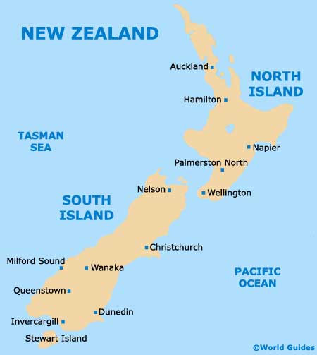
Map of New Zealand
Map of Milford Sound