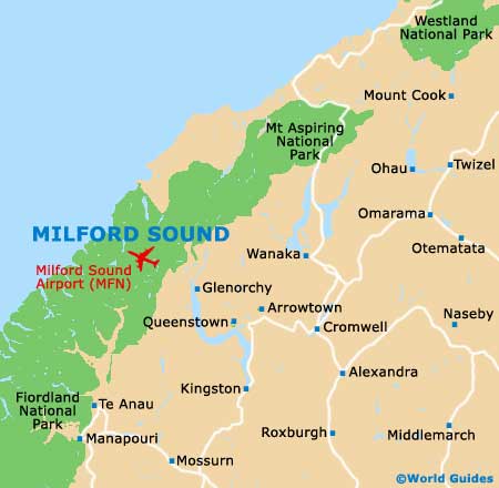
Milford Sound Landmarks and Monuments
(Milford Sound, South Island, New Zealand)
Milford Sound's landmarks are obvious - mountain peaks and water - and it really is worth travelling all the way to
New Zealand just to visit this pristine sight. Once you have done the Sound cruise, you could also think about flying over the area to get a bird's-eye view.
There are also sights to see nearby. The Milford Road itself is worth a trip from Te Anau, as it passes pretty scenery and incorporates the lengthy Homer Tunnel. Te Anau also boasts the largest lake in the region, which comes with impressive caves.
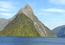
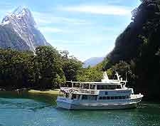
Mitre Peak
Address: Milford Sound, New Zealand, NZ
This lofty peak is the iconic sight of the Fiordland National Park. The pyramidal mountain pokes up through the glassy waters of Milford Sound to a height of 1,690 metres / 5,550 feet, with a depth below the waterline of another 500 metres / 1,640 feet or so. Mitre Peak is, in fact, a group of five peaks looking like one large one from the shore. Cruises go right beneath the mountain and offer great views from a different angle.
Open hours: daily
Admission: free, charge for cruise
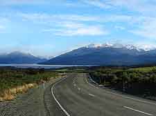
Milford Road
Address: Milford Sound, New Zealand, NZ
This lengthy and extremely scenic road (120 km / 75 miles) from Te Anau links Milford Sound and was built in the '50s. The road was almost two decades in the making and involved the construction of the Homer Tunnel, which opened in 1954 and runs just under 1,300 metres / 4,265 feet through the 'Main Divide', connecting Eglinton Valley and Cleddau. Journey time from Te Anau is around two hours, and another two to
Queenstown. A good option for those arriving by bus is to fly back out.
Open hours: October to May
Admission: free
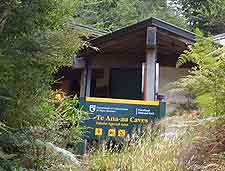
Te Anau Caves
Address: Te Anau, New Zealand
Tel: +64 03 249 7416
This fantastic cave system near Te Anau involves a boat trip across the lake and a guided tour. These are a part of the Aurora Caves and come with walking paths and gantries, along with a paddle boat ride to spot the glow-worms. There are also underground waterfalls and large caverns to take in. Trip time is a little over two hours, including the hour's cruise there and back.
Open hours: daily
Admission: charge, discount for children under 15 years, children under five years go free
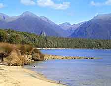
Lake Te Anau
Address: Te Anau, New Zealand
Lying south of Milford Sound is the huge Te Anau Lake, which requires a cruise to access the start of the Milford Track. This is New Zealand's second-biggest lake after Lake Taupo and covers an area of almost 350 square kilometres / 135 square miles, with hundreds of kilometres of uninhabited shoreline. A number of different rivers feed Lake Te Anau, with the Eglinton River being the most important and joining from the eastern side. The town of Te Anau is at the south bank and you will travel past here if you approach Milford Sound by road.
Open hours: daily
Admission: free
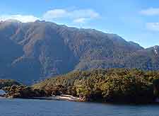
Lake Manapouri
Address: Manapouri, New Zealand
Another noted landmark in the area is Lake Manapouri, a sizeable body of water just south of Lake Te Anau. It is pockmarked with islands and you can get a cruise to some of them. The main attraction for many is the power station on the West Arm, which is huge and underground. Lake Manapouri is fed by the Waiau River on the north-eastern side, which also provides a natural outlet to the south-east. The shoreline is especially picturesque, with much of the backdrop being provided by the Hunter Mountains, the Kepler Mountains and the Turret Range. Tourists often like to pay a visit to the small settlement of Manapouri, on the eastern shore.
Open hours: daily
Admission: free