Lombok Maps and Orientation
(Lombok, West Nusa Tenggara, Indonesia)
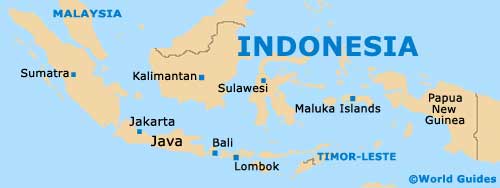
Located within the Indonesian province of West Nusa Tenggara, the island of Lombok is especially close to
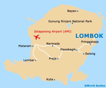
Bali and Sumbawa, which are separated by the Lombok Strait and the Alas Strait respectively. Mataram serves as the biggest city and is also the island's capital, being sited in the centre of the western coastline.
Northern Lombok is rather dominated by the Gunung Rinjani National Park, which encompasses more than 400 square kilometres / 154 square miles and contains a fairly mountainous landscape. Mount Rinjani (Gunung Rinjani) dominates much of this national park and is its very famous namesake.
Maps and Orientation of the Island
If you are planning to find your own way around Lombok, then a good map is essential. Apart from Mataram, other prominent tourist towns and resorts include Bangsal, which is home to a charming harbourfront, where ferries connect the nearby Gili Islands. Kuta lies on the far southerly coastline and it is a major surfing destination, while Anyar is to be found on the northerly shore and is close to some beautiful beaches.
Praya is another important city on Lombok and stands on the southerly side of the central region. Those catching boats to Bali should head to Lembar, on the south-western side of Lombok. For some of the best beaches, Senggigi is the place to be and is close to the acclaimed Mangsit Beach, being situated just a short distance to the north of Mataram.
Map of Indonesia
Map of Lombok