Solo Maps and Orientation
(Solo, Central Java, Indonesia)
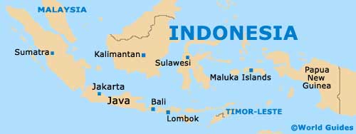
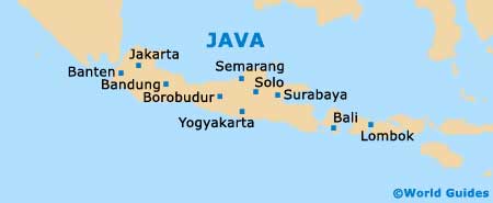
A prominent city located on the easterly side of Central Java, Solo also goes by the name of Surakarta, and is an important remnant of the past Mataram Kingdom, which separated in the mid-19th century. Solo is to be found some 100 km / 62 miles to the south-east of Semarang, and approximately 60 km / 37 miles to the east of nearby Yogyakarta.
Since Solo does not serve as a provincial capital, it has managed to retain much of its charming Javanese character, remaining noticeably less touristy than other parts of Java. The city's population is now around 600,000 people, although if the suburbs are included, this figure rockets to 800,000.
Maps and Orientation of the City
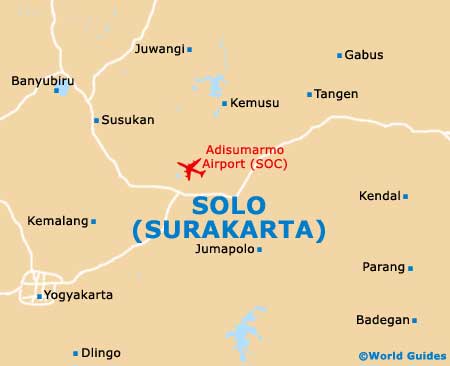
The city's main artery road is the Jalan Slamet Riyadi, which runs in an east to west direction, and through central Solo. Many hotels are to be found on or nearby the Jalan Slamet Riyadi, along with a good selection of places to eat and the tourist office, where maps can be found and travel organised.
The Balapan railway station is situated on the northerly side of the city and some 2 km / 1.5 miles from Solo city centre, being close to the Gilingan minibuses. On the south-eastern side of Solo, the
Kraton Surakarta marks the most historical part of the city itself.
- Borobudur - 90 km / 56 miles (one hour and 45 minutes, west)
- Gemarang - 127 km / 79 miles (two hours and 35 minutes, east)
- Jepara - 160 km / 99 miles (three hours and ten minutes, north)
- Jombang - 195 km / 121 miles (three hours and 20 minutes, east)
- Jumapolo - 21 km / 13 miles (30 minutes, south-east)
- Juwangi - 81 km / 50 miles (one hour and 35 minutes, north)
- Kajoran - 102 km / 63 miles (two hours, west)
- Malang - 298 km / 185 miles (five hours and 45 minutes, south-east)
- Mojo - 196 km / 122 miles (four hours, south-east)
- Pacitan - 120 km / 75 miles (two hours and 20 minutes, south)
- Polokarto - 16 km / 10 miles (20 minutes, south-east)
- Rembang - 155 km / 96 miles (three hours, north-east)
- Sadang - 160 km / 99 miles (three hours, west)
- Semarang - 107 km / 66 miles (two hours and five minutes, north-west)
- Surabaya - 265 km / 165 miles (five hours, north-east)
- Yogyakarta - 66 km / 41 miles (one hour and 15 minutes, south-west)
Map of Indonesia
Map of Java
Map of Solo