Hong Kong Maps and Orientation
(Hong Kong, China)
The vast territory that is Hong Kong covers some 1,102 square kilometres / 425 square miles and is roughly split into no less than four individual areas. These areas are known as Kowloon, Hong Kong Island, the New Territories and also the Outlying Islands.
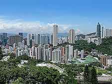
Hong Kong Island is situated on the southerly side of the territory tends to be where much of the action happens, serving as an important economic and commercial centre, particularly around its Central district. Further important neighbourhoods around Hong Kong Island include Causeway Bay, Fortress Hill, North Point, Quarry Bay, Sheung Wan and also Wan Chai.
Maps and Orientation of the City
Sited just to the north, Kowloon is a densely popular place and enjoys a scenic peninsula setting, where its buzzing Tsim Sha Tsui area has become something of a tourist hotspot. Kowloon is a very modern part of Hong Kong and is filled with towering skyscrapers and waterfront views.
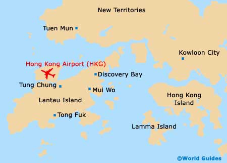
The northerly New Territories encompasses just over 88 percent of the entire Hong Kong region and officially comprises the 234 Outlying Islands, which includes Lantau.
The majority of travellers won't really need much more than a simple map of the area, and those provided by the Hong Kong Tourist Board (HKTB) are usually more than adequate for most.
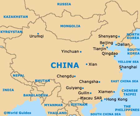
- Fuzhou - north-east
- Guangzhou - north
- Haikou - south-west
- Macau - west
- Nanning - west
- Nantou - north-west
- Shantou - north-east
- Shekou - north-west
- Shenzhen - north
- Taipei (Taiwan) - north-east
- Xiamen - north-east
- Zhuhai - west
Map of China
Map of Hong Kong