Libya Maps and Orientation
(Libya, LY, North Africa)
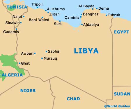
The African country of Libya resides in North Africa, where its northerly coastline fronts the Mediterranean Sea. Other boundaries are formed by surrounding African countries, with Libya lying directly to the west of Egypt, to the north-west of Sudan, to the north of both Chad and Niger, and to the east of Algeria and Tunisia.
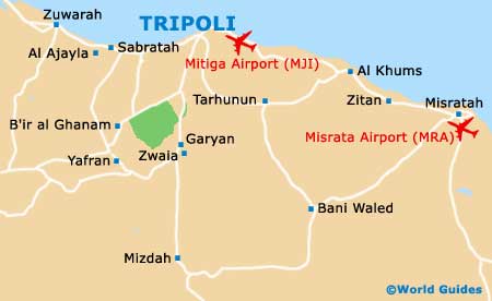
With so much of Libya being covered by the Sahara Desert, sightseers generally head straight to the capital city of
Tripoli, which lies on the western side of the northern shore and close to Tunisia. Whilst maps of Tripoli may be useful, as long as you can see the
Assaraya al-Hamra fortress, next to Green Square (Martyrs Square), you should be able to get your bearings.
Maps and Orientation of the Country
Other significant destinations located along Libya's Mediterranean coast include Al Khoms (Al Khums), Benghazi, Cyrene, Darnah, Leptis Magna, Surt, Tobruk, Tolmeitha and Zuwara. To the north of Tobruk, the Greek island of
Crete is surprisingly close and easy to reach by boat.
Close to the western border are both Ghat and Ghadames, while Sabha resides near to the centre, and Al Jawf and Ayn al Ghazai can be found in the south-east.
- Algeria - west
- Chad - south
- Egypt - east
- Niger - south
- Sudan - south-east
- Tunisia - north-west
Continent Map of Africa

Map of Libya
Map of Tripoli