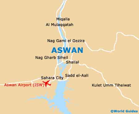
Aswan Maps and Orientation
(Aswan, Egypt)
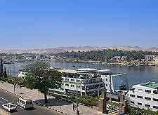
Located on the southern side of Egypt, where it has long been one of the region's most important cities and also the Aswan Governorate's capital, Aswan stands directly north of Lake Nasser. Relatively close to the Sudan border, which lies to the south, the Aswan lies on the easterly banks of the River Nile and also comprises the popular tourist destination known as the Elephantine Island.
The River Nile is extremely wide directly above Aswan and stretches for around 275 metres / 900 feet, being more than 700 miles / 1,127 km long in total.
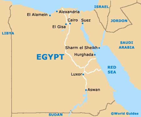
Alexandria lies on the far northern coast of Egypt and many tourists holidaying in Aswan choose to reach this city by means of a cruise along the River Nile, which generally takes anywhere between three or four weeks and is always extremely scenic.
Maps and Orientation of the City
Aswan is one of a number noteworthy tourist destinations located right next to the River Nile, with the more northerly city of
Luxor being another and easily reached by bus. In fact, many carved obelisks now standing in Luxor actually originated from the granite quarries here. The city of Aswan has a total population of approximately 200,000 people, which helps to give an impression of its significance and overall size.
Maps of central Aswan aren't really needed, since there are only three main streets in the city, and most of the attractions simply line the banks of the River Nile. These are the Corniche el-Nile (Corniche el-Nil), the market street of Sharia as-Souq (Sharia Saad Zaghloul) and also the Sharia Abtal at-Tahrir.
- Abu Simbel - south-west
- Sadd el-Aali - south
- Kom Ombo - north
- Nasr City - north
- Silwa Bahari - north
- Ezbet Dush - west
- Ginah - north-west
- Kharga - north-west
- Sohag - north
- Asyut - north
- Luxor - north
- Minya - north
- Barramiya - north-east
- Marsa Alam - east
- Berenice - east
Continent Map of Africa

Map of Egypt
Map of Aswan