Gatlinburg Maps and Orientation
(Gatlinburg, Tennessee - TN, USA)
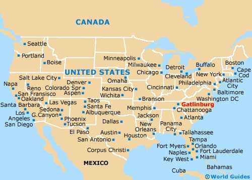
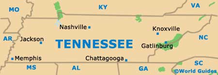
Often regarded as a mountain resort city, Gatlinburg lies on the eastern side of Tennessee, being found roughly an hour to the southeast of Knoxville. Gatlinburg is one of the most popular cities in Sevier County, due to its proximity to the Great Smoky Mountains National Park and good connections provided by the US-441 highway.
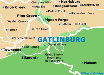
The city is encircled by a series of mountains and high ridges. Standing to the south is Sugarland Mountain, while the Grapeyard Ridge lies on the eastern outskirts and Cove Mountain is to be found to the west. The West Prong of the Little Pigeon River connects Gatlinburg with neighboring Pigeon Forge, to the north.
The Gatlinburg Golf Course is a popular local attraction and resides close to Pigeon Forge, while further north is the airport and the city of Sevierville, the county seat. The Black Bear Falls community is just a matter of minutes away and to the northeast, being a popular choice for those looking for accommodation in natural surroundings.
Maps and Orientation of the City
Many visitors to Gatlinburg choose to rent a car during their stay, since there are so many attractions surrounding the city, such as Dollywood at Pigeon Forge. In the city center itself, maps aren't really necessary, since it is easy to find your way around on foot.
The Gatlinburg Space Needle makes a useful point of reference, as does the Convention Center, the Village Shopping Center and the Ole Smoky Tennessee Moonshine distillery, all of which are within minutes of each other and reside along the US-441 (Parkway).
- Alcoa - 43 miles / 69 km (one hour and ten minutes, west)
- Big Ridge State Park - 62 miles / 100 km (one hour and 30 minutes, north)
- Black Bear Falls - 3 miles / 5 km (ten minutes, northeast)
- Bruson City - 48 miles / 77 km (one hour and 15 minutes, south)
- Cherokee - 35 miles / 56 km (55 minutes, south)
- Corryton - 50 miles / 80 km (one hour and 15 minutes, northwest)
- Jefferson City - 40 miles / 64 km (one hour and five minutes, north)
- Knoxville - 38 miles / 61 km (one hour, northwest)
- Maryville - 41 miles / 66 km (one hour and five minutes, west)
- Newport - 32 miles / 51 km (50 minutes, northeast)
- Pigeon Forge - 7 miles / 11 km (15 minutes, north)
- Pittman Center - 9 miles / 14 km (15 minutes, east)
- Sevierville - 13 miles / 21 km (20 minutes, north)
- Seymour - 27 miles / 43 km (40 minutes, northwest)
- Strawberry Plains - 30 miles / 48 km (50 minutes, north)
- Walland - 32 miles / 51 km (50 minutes, west)
- Whittier - 43 miles / 69 km (one hour and ten minutes, south)
Map of the United States
Map of Tennessee
Map of Gatlinburg